| Name | Kirchstraße (name)
|
| Type | highway:residential |
| Last Updated | 2018-12-04 11:00 |
| Admin Level | 15 |
| Rank | Street / Major Landmark |
| Importance | 0.1 (estimated) |
| Coverage | Point |
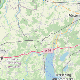
| Centre Point | 48.1504624,11.2555036 |
| OSM | way 24619012 |
| Computed Postcode | 82239 |
| Address Tags | |
| Extra Tags | 50 (maxspeed)
asphalt (surface)
|
| Local name | Type | OSM | Address rank | Admin level | Distance | |
| Kirchstraße | highway:residential | way 24619012 | 26 | 0 | details > | |
| Fürstenfeld | place:suburb | node 1700541694 | 20 | 0 | details > | |
| Bruck | place:suburb | node 314392052 | 20 | 0 | details > | |
| Buchenau | place:suburb | node 314392047 | 20 | 0 | details > | |
| Alling | place:village | relation 933491 | 16 | 8 | 0 | details > |
| Neuried | place:hamlet | node 297576073 | 16 | 0 | details > | |
| Biburg | place:village | node 104651268 | 16 | 0 | details > | |
| Pfaffing | place:hamlet | node 314392025 | 16 | 0 | details > | |
| Angerhof | place:hamlet | node 507751830 | 16 | 0 | details > | |
| Landkreis Fürstenfeldbruck | boundary:administrative | relation 62595 | 12 | 6 | 0 | details > |
| Obb | boundary:administrative | relation 2145274 | 10 | 5 | 0 | details > |
| Bayern | place:state | relation 2145268 | 8 | 4 | 0 | details > |
| 82239 | place:postcode | 5 | 0 | |||
| 82239 | place:postcode | relation 1104829 | 5 | 0 | details > | |
| Deutschland | place:country | relation 51477 | 4 | 2 | ~3 m | details > |
| de | place:country_code | 4 | 0 | |||
Parent Of | ||||||
Building | ||||||
| No Name | building:yes | way 359821047 | 30 | ~22 m | details > | |
| No Name | building:yes | way 359821044 | 30 | ~7 m | details > | |
| No Name | building:yes | way 359116272 | 30 | ~18 m | details > | |
| No Name | building:yes | way 359821045 | 30 | ~14 m | details > | |
| No Name | building:yes | way 484965203 | 30 | ~16 m | details > | |
| No Name | building:yes | way 359116271 | 30 | ~25 m | details > | |