| Name | Welmlingen (name)
|
| Type | place:village |
| Last Updated | 2018-12-03 18:16 |
| Admin Level | 15 |
| Rank | Other: 19 |
| Importance | 0.275 (estimated) |
| Coverage | Polygon |
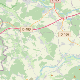
| Centre Point | 47.6900902,7.5618118 |
| OSM | way 24781880 |
| Computed Postcode | |
| Address Tags | |
| Extra Tags | village (place)
|
| Local name | Type | OSM | Address rank | Admin level | Distance | |
| Welmlingen | place:village | way 24781880 | 16 | 0 | details > | |
| Efringen-Kirchen | place:village | relation 1130296 | 16 | 8 | 0 | details > |
| Landkreis Lörrach | boundary:administrative | relation 62587 | 12 | 6 | 0 | details > |
| Regierungsbezirk Freiburg | boundary:administrative | relation 2106112 | 10 | 5 | 0 | details > |
| Baden-Württemberg | place:state | relation 62611 | 8 | 4 | ~2 m | details > |
| Deutschland | place:country | relation 51477 | 4 | 2 | ~5 m | details > |
| de | place:country_code | 4 | 0 | |||
Linked Places | ||||||
| Welmlingen | place:village | node 269272632 | 16 | 0 | details > | |
Parent Of | ||||||
Residential | ||||||
| Alte Landstraße | highway:residential | way 24781746 | 26 | ~79 m | details > | |
| Alte Landstraße | highway:residential | way 24781747 | 26 | ~117 m | details > | |
| Alte Landstraße | highway:residential | way 197990765 | 26 | ~75 m | details > | |
| Alte Landstraße | highway:residential | way 197990766 | 26 | ~32 m | details > | |
| Am Kirchberg | highway:residential | way 41847801 | 26 | ~200 m | details > | |
| Blauenblick | highway:residential | way 41847807 | 26 | ~185 m | details > | |
| Blauenblick | highway:residential | way 197990771 | 26 | ~196 m | details > | |
| Brunnenplatz | highway:residential | way 276603107 | 26 | ~87 m | details > | |
| Friedhofstraße | highway:residential | way 197990773 | 26 | ~149 m | details > | |
| Haselstraße | highway:residential | way 197990781 | 26 | ~274 m | details > | |
| Im Rumpel | highway:residential | way 41847800 | 26 | ~57 m | details > | |
| Lettenweg | highway:residential | way 276793005 | 26 | ~64 m | details > | |
| Mühlenweg | highway:residential | way 197990787 | 26 | ~334 m | details > | |
| Mühlenweg | highway:residential | way 197990786 | 26 | ~275 m | details > | |
| Mühlenweg | highway:residential | way 41847793 | 26 | ~329 m | details > | |
| Ob der Schule | highway:residential | way 197990788 | 26 | ~225 m | details > | |
| Riedstraße | highway:residential | way 547505768 | 26 | ~130 m | details > | |
| Schulstraße | highway:residential | way 41847798 | 26 | ~202 m | details > | |
| Schulstraße | highway:residential | way 41847792 | 26 | ~369 m | details > | |
| Steingasse | highway:residential | way 197990789 | 26 | ~42 m | details > | |
| Steingasse | highway:residential | way 41847799 | 26 | ~41 m | details > | |
| Steingasse | highway:residential | way 197990790 | 26 | ~42 m | details > | |
Primary | ||||||
| Freiburger Straße | highway:primary | way 24781881 | 26 | ~247 m | details > | |
| Freiburger Straße | highway:primary | way 197990769 | 26 | ~96 m | details > | |
| Freiburger Straße | highway:primary | way 197990767 | 26 | ~226 m | details > | |
| Freiburger Straße | highway:primary | way 197990768 | 26 | ~94 m | details > | |
| Freiburger Straße | highway:primary | way 197990770 | 26 | ~93 m | details > | |
Unclassified | ||||||
| Haselstraße | highway:unclassified | way 197990779 | 26 | ~148 m | details > | |
| Haselstraße | highway:unclassified | way 276603108 | 26 | ~155 m | details > | |
| Haselstraße | highway:unclassified | way 197990780 | 26 | ~152 m | details > | |
| Holzenweg | highway:unclassified | way 197990782 | 26 | ~181 m | details > | |
| Holzenweg | highway:unclassified | way 197990783 | 26 | ~121 m | details > | |
| Holzenweg | highway:unclassified | way 26829031 | 26 | ~191 m | details > | |
| No Name | highway:unclassified | way 197990800 | 26 | ~124 m | details > | |
| No Name | highway:unclassified | way 151348224 | 26 | ~157 m | details > | |
Track | ||||||
| Lettenweg | highway:track | way 276793002 | 26 | ~122 m | details > | |
Service | ||||||
| Walter-Wetzel-Straße | highway:service | way 151348236 | 27 | ~300 m | details > | |