| Name | Waldstraße (name)
|
| Type | highway:service |
| Last Updated | 2018-12-05 15:49 |
| Admin Level | 15 |
| Rank | Minory Street / Path |
| Importance | 0.075 (estimated) |
| Coverage | Point |
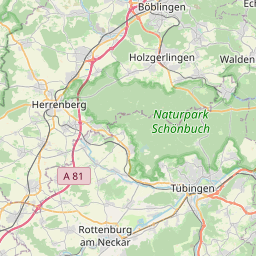
| Centre Point | 48.747861,8.972167 |
| OSM | way 24800070 |
| Computed Postcode | 71106 |
| Address Tags | |
| Extra Tags |
| Local name | Type | OSM | Address rank | Admin level | Distance | |
| Waldstraße | highway:service | way 24800070 | 27 | 0 | details > | |
| Heuweg | place:suburb | node 288393076 | 20 | 0 | details > | |
| Ezach | place:suburb | node 276002814 | 20 | 0 | details > | |
| Magstadt | place:village | relation 722147 | 16 | 8 | 0 | details > |
| Landkreis Böblingen | boundary:administrative | relation 62721 | 12 | 6 | 0 | details > |
| Regierungsbezirk Stuttgart | boundary:administrative | relation 22041 | 10 | 5 | 0 | details > |
| Baden-Württemberg | place:state | relation 62611 | 8 | 4 | 0 | details > |
| 71106 | place:postcode | 5 | 0 | |||
| 71106 | place:postcode | relation 3377994 | 5 | 0 | details > | |
| Deutschland | place:country | relation 51477 | 4 | 2 | ~3 m | details > |
| de | place:country_code | 4 | 0 | |||
Parent Of | ||||||
Building | ||||||
| No Name | building:yes | way 387998851 | 30 | ~71 m | details > | |
| No Name | building:yes | way 35144279 | 30 | ~65 m | details > | |
| No Name | building:yes | way 387998857 | 30 | ~59 m | details > | |
| No Name | building:yes | way 387998859 | 30 | ~52 m | details > | |
| No Name | building:yes | way 387998865 | 30 | ~46 m | details > | |
| No Name | building:yes | way 387998867 | 30 | ~31 m | details > | |
| No Name | building:yes | way 387998868 | 30 | ~24 m | details > | |
| No Name | building:yes | way 387998869 | 30 | ~18 m | details > | |
| No Name | building:yes | way 387998870 | 30 | ~13 m | details > | |
| No Name | building:yes | way 35144280 | 30 | ~8 m | details > | |
| No Name | building:yes | way 387998873 | 30 | ~8 m | details > | |