| Name | Am Hohenrand (name)
|
| Type | highway:unclassified |
| Last Updated | 2018-12-04 11:00 |
| Admin Level | 15 |
| Rank | Street / Major Landmark |
| Importance | 0.1 (estimated) |
| Coverage | Point |
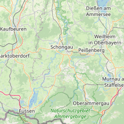
| Centre Point | 47.9257325,11.399806 |
| OSM | way 24969140 |
| Computed Postcode | 82335 |
| Address Tags | |
| Extra Tags | yes (oneway)
asphalt (surface)
|
| Local name | Type | OSM | Address rank | Admin level | Distance | |
| Am Hohenrand | highway:unclassified | way 24969140 | 26 | 0 | details > | |
| Nantwein | place:suburb | node 2012559068 | 20 | 0 | details > | |
| Weidach | place:suburb | node 59904021 | 20 | 0 | details > | |
| Berg | place:village | relation 932489 | 16 | 8 | 0 | details > |
| Attenhausen | place:hamlet | node 2130446378 | 16 | 0 | details > | |
| Dorfen | place:village | node 65137146 | 16 | 0 | details > | |
| Höhenrain | place:village | node 259973938 | 16 | 0 | details > | |
| Meilenberg | place:hamlet | node 65137150 | 16 | 0 | details > | |
| Alpe | place:village | node 2130446373 | 16 | 0 | details > | |
| Landkreis Starnberg | boundary:administrative | relation 62458 | 12 | 6 | 0 | details > |
| Obb | boundary:administrative | relation 2145274 | 10 | 5 | 0 | details > |
| Bayern | place:state | relation 2145268 | 8 | 4 | ~1 m | details > |
| 82335 | place:postcode | 5 | 0 | |||
| 82335 | place:postcode | relation 1104727 | 5 | 0 | details > | |
| Deutschland | place:country | relation 51477 | 4 | 2 | ~4 m | details > |
| de | place:country_code | 4 | 0 | |||
Parent Of | ||||||
Building | ||||||
| Brauerei Starnberger Brauhaus | building:yes | way 451393716 | 30 | ~12 m | details > | |
| No Name | building:yes | way 234085005 | 30 | ~55 m | details > | |
| No Name | building:yes | way 451393715 | 30 | ~40 m | details > | |
Recycling | ||||||
| No Name | amenity:recycling | node 5320992619 | 30 | ~47 m | details > | |