| Name | Aalstraße (name)
|
| Type | highway:residential |
| Last Updated | 2018-12-04 10:59 |
| Admin Level | 15 |
| Rank | Street / Major Landmark |
| Importance | 0.1 (estimated) |
| Coverage | Point |
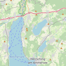
| Centre Point | 48.0603146,11.1642942 |
| OSM | way 25526824 |
| Computed Postcode | 82266 |
| Address Tags | |
| Extra Tags |
| Local name | Type | OSM | Address rank | Admin level | Distance | |
| Aalstraße | highway:residential | way 25526824 | 26 | 0 | details > | |
| Inning am Ammersee | place:village | relation 932279 | 16 | 8 | 0 | details > |
| Bachern | place:village | node 1700548625 | 16 | 0 | details > | |
| Landkreis Starnberg | boundary:administrative | relation 62458 | 12 | 6 | 0 | details > |
| Obb | boundary:administrative | relation 2145274 | 10 | 5 | 0 | details > |
| Bayern | place:state | relation 2145268 | 8 | 4 | 0 | details > |
| 82266 | place:postcode | 5 | 0 | |||
| 82266 | place:postcode | relation 1104732 | 5 | 0 | details > | |
| Deutschland | place:country | relation 51477 | 4 | 2 | ~3 m | details > |
| de | place:country_code | 4 | 0 | |||
Parent Of | ||||||
Castle | ||||||
| Wörthseeschlössl | historic:castle | way 82574550 | 30 | ~494 m | details > | |
Building | ||||||
| No Name | building:yes | way 318810438 | 30 | ~43 m | details > | |
| No Name | building:yes | way 318810482 | 30 | ~47 m | details > | |
| No Name | building:yes | way 318810392 | 30 | ~44 m | details > | |
| No Name | building:yes | way 318810401 | 30 | ~31 m | details > | |
| No Name | building:yes | way 318810408 | 30 | ~9 m | details > | |
| No Name | building:yes | way 364249838 | 30 | ~13 m | details > | |
Pier | ||||||
| No Name | man_made:pier | way 362257083 | 30 | ~87 m | details > | |
| No Name | man_made:pier | way 362257086 | 30 | ~86 m | details > | |
| No Name | man_made:pier | way 364701407 | 30 | ~125 m | details > | |
| No Name | man_made:pier | way 364701406 | 30 | ~103 m | details > | |