| Name | Edith-Stein-Straße (name)
|
| Type | highway:residential |
| Last Updated | 2018-12-04 18:53 |
| Admin Level | 15 |
| Rank | Street / Major Landmark |
| Importance | 0.1 (estimated) |
| Coverage | Point |
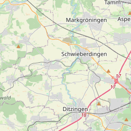
| Centre Point | 48.8853253,9.1315488 |
| OSM | way 26132923 |
| Computed Postcode | 71696 |
| Address Tags | |
| Extra Tags | 2 (lanes)
30 (maxspeed)
paved (surface)
4 (width)
|
| Local name | Type | OSM | Address rank | Admin level | Distance | |
| Edith-Stein-Straße | highway:residential | way 26132923 | 26 | 0 | details > | |
| Hurst | place:isolated_dwelling | node 2502004658 | 20 | 0 | details > | |
| Müllerheim | place:suburb | node 218766156 | 20 | 0 | details > | |
| Kallenberg | place:suburb | node 4239974006 | 20 | 0 | details > | |
| Möglingen | place:village | relation 405810 | 16 | 8 | 0 | details > |
| Landkreis Ludwigsburg | boundary:administrative | relation 62536 | 12 | 6 | 0 | details > |
| Regierungsbezirk Stuttgart | boundary:administrative | relation 22041 | 10 | 5 | 0 | details > |
| Baden-Württemberg | place:state | relation 62611 | 8 | 4 | 0 | details > |
| 71696 | place:postcode | 5 | 0 | |||
| 71696 | place:postcode | relation 3377983 | 5 | 0 | details > | |
| Deutschland | place:country | relation 51477 | 4 | 2 | ~3 m | details > |
| de | place:country_code | 4 | 0 | |||
Parent Of | ||||||
Building | ||||||
| No Name | building:yes | way 410325051 | 30 | ~47 m | details > | |
| No Name | building:yes | way 410325038 | 30 | ~55 m | details > | |
| No Name | building:yes | way 410324890 | 30 | ~32 m | details > | |
| No Name | building:yes | way 548510509 | 30 | ~40 m | details > | |
| No Name | building:yes | way 410324989 | 30 | ~27 m | details > | |
Playground | ||||||
| No Name | leisure:playground | way 634408093 | 30 | ~52 m | details > | |