| Name | Scherenweg (name)
|
| Type | highway:track |
| Last Updated | 2018-12-05 03:43 |
| Admin Level | 15 |
| Rank | Street / Major Landmark |
| Importance | 0.1 (estimated) |
| Coverage | Point |
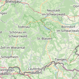
| Centre Point | 47.9471154,7.7787005 |
| OSM | way 26198065 |
| Computed Postcode | 79285 |
| Address Tags | 79285 (postcode)
|
| Extra Tags | 1 (lanes)
agricultural (motor_vehicle)
grade2 (tracktype)
|
| Local name | Type | OSM | Address rank | Admin level | Distance | |
| Scherenweg | highway:track | way 26198065 | 26 | 0 | details > | |
| Grünwinkel | place:neighbourhood | node 5036557659 | 22 | 0 | details > | |
| Siedlung | place:neighbourhood | node 2798381532 | 22 | 0 | details > | |
| Wiedenhut | place:neighbourhood | node 2809420448 | 22 | 0 | details > | |
| Hinterdorf | place:neighbourhood | node 2798381517 | 22 | 0 | details > | |
| Mitteldorf | place:neighbourhood | node 2798381522 | 22 | 0 | details > | |
| Dammen | place:neighbourhood | node 2799052710 | 22 | 0 | details > | |
| Unterdorf | place:neighbourhood | node 2798381534 | 22 | 0 | details > | |
| Oberdorf | place:neighbourhood | node 2798381523 | 22 | 0 | details > | |
| Herrengarten | place:neighbourhood | node 2798381516 | 22 | 0 | details > | |
| Birkental | place:neighbourhood | node 2803654635 | 22 | 0 | details > | |
| Kaiserstuhl | place:neighbourhood | node 2812421837 | 22 | 0 | details > | |
| Talhausen | boundary:administrative | relation 7010505 | 20 | 10 | 0 | details > |
| Ebringen | place:village | relation 1946218 | 16 | 8 | 0 | details > |
| VVG der Gemeinde Schallstadt | boundary:administrative | relation 1946221 | 14 | 7 | 0 | details > |
| Landkreis Breisgau-Hochschwarzwald | boundary:administrative | relation 1946367 | 12 | 6 | 0 | details > |
| Regierungsbezirk Freiburg | boundary:administrative | relation 2106112 | 10 | 5 | 0 | details > |
| Baden-Württemberg | place:state | relation 62611 | 8 | 4 | ~1 m | details > |
| 79285 | place:postcode | 5 | 0 | |||
| 79285 | place:postcode | relation 3361764 | 5 | 0 | details > | |
| Deutschland | place:country | relation 51477 | 4 | 2 | ~4 m | details > |
| de | place:country_code | 4 | 0 | |||
Parent Of | ||||||
Embankment | ||||||
| No Name | man_made:embankment | way 372635837 | 30 | ~6 m | details > | |