| Name | Brünnelebuck (name)
|
| Type | highway:residential |
| Last Updated | 2018-12-05 03:41 |
| Admin Level | 15 |
| Rank | Street / Major Landmark |
| Importance | 0.1 (estimated) |
| Coverage | Point |
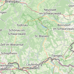
| Centre Point | 48.1011668,7.6005667 |
| OSM | way 26796621 |
| Computed Postcode | 79235 |
| Address Tags | |
| Extra Tags | 30 (maxspeed)
|
| Local name | Type | OSM | Address rank | Admin level | Distance | |
| Brünnelebuck | highway:residential | way 26796621 | 26 | 0 | details > | |
| Neumühle | place:isolated_dwelling | node 2795158934 | 20 | 0 | details > | |
| Blauwasserhof | place:isolated_dwelling | node 5392834887 | 20 | 0 | details > | |
| Burkheim | boundary:administrative | relation 70163 | 18 | 9 | 0 | details > |
| Vogtsburg im Kaiserstuhl | place:municipality | relation 70147 | 16 | 8 | 0 | details > |
| Burkheim | place:village | node 477929265 | 16 | 0 | details > | |
| Landkreis Breisgau-Hochschwarzwald | boundary:administrative | relation 1946367 | 12 | 6 | 0 | details > |
| Regierungsbezirk Freiburg | boundary:administrative | relation 2106112 | 10 | 5 | 0 | details > |
| Baden-Württemberg | place:state | relation 62611 | 8 | 4 | ~2 m | details > |
| 79235 | place:postcode | 5 | 0 | |||
| 79235 | place:postcode | relation 3372411 | 5 | 0 | details > | |
| Deutschland | place:country | relation 51477 | 4 | 2 | ~4 m | details > |
| de | place:country_code | 4 | 0 | |||
Parent Of | ||||||
Building | ||||||
| No Name | building:yes | way 166043618 | 30 | ~11 m | details > | |
| No Name | building:yes | way 166043701 | 30 | ~16 m | details > | |
| No Name | building:yes | way 166043624 | 30 | ~29 m | details > | |
| No Name | building:yes | way 110140455 | 30 | ~52 m | details > | |
| No Name | building:yes | way 166043683 | 30 | ~8 m | details > | |
| No Name | building:yes | way 307080141 | 30 | ~7 m | details > | |
| No Name | building:yes | way 307080143 | 30 | ~14 m | details > | |
| No Name | building:yes | way 110140603 | 30 | ~30 m | details > | |
| No Name | building:yes | way 563256570 | 30 | ~54 m | details > | |
House | ||||||
| No Name | place:house | node 848540265 | 30 | ~140 m | details > | |