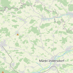
| Name | Asbach (place_name)
|
| Type | place:village |
| Last Updated | 2018-12-03 18:03 |
| Admin Level | 15 |
| Rank | Other: 19 |
| Importance | 0.275 (estimated) |
| Coverage | Polygon |
| Centre Point | 48.3924773,11.4609660587066 |
| OSM | way 26818004 |
| Computed Postcode | 85238 |
| Address Tags | 85238 (postcode)
|
| Extra Tags |
| Local name | Type | OSM | Address rank | Admin level | Distance | |
| Asbach | place:village | way 26818004 | 16 | 0 | details > | |
| Petershausen | place:village | relation 934479 | 16 | 8 | 0 | details > |
| Landkreis Dachau | boundary:administrative | relation 62556 | 12 | 6 | 0 | details > |
| Obb | boundary:administrative | relation 2145274 | 10 | 5 | 0 | details > |
| Bayern | place:state | relation 2145268 | 8 | 4 | 0 | details > |
| 85238 | place:postcode | 5 | 0 | |||
| Deutschland | place:country | relation 51477 | 4 | 2 | ~3 m | details > |
| de | place:country_code | 4 | 0 | |||
Parent Of | ||||||
Unclassified | ||||||
| Auenweg | highway:unclassified | way 22529688 | 26 | ~115 m | details > | |
| Dorfstraße | highway:unclassified | way 93950885 | 26 | ~237 m | details > | |
| Dorfstraße | highway:unclassified | way 86330874 | 26 | ~4 m | details > | |
| Dorfstraße | highway:unclassified | way 26817997 | 26 | ~225 m | details > | |
| Dorfstraße | highway:unclassified | way 26818003 | 26 | ~6 m | details > | |
| Dorfstraße | highway:unclassified | way 32200563 | 26 | ~199 m | details > | |
| Dorfstraße | highway:unclassified | way 26817998 | 26 | ~351 m | details > | |
| Moosweg | highway:unclassified | way 22529695 | 26 | ~162 m | details > | |
| Staudenweg | highway:unclassified | way 22529683 | 26 | ~129 m | details > | |
| Vierkirchner Straße | highway:unclassified | way 22529685 | 26 | ~210 m | details > | |
| Vierkirchner Straße | highway:unclassified | way 93950882 | 26 | ~276 m | details > | |
| Vierkirchner Straße | highway:unclassified | way 93950883 | 26 | ~142 m | details > | |
| Wiesenweg | highway:unclassified | way 22529682 | 26 | ~102 m | details > | |
Residential | ||||||
| Bruckweg | highway:residential | way 22529677 | 26 | ~6 m | details > | |
| Kräuterweg | highway:residential | way 42481001 | 26 | ~197 m | details > | |
Service | ||||||
| Vierkirchner Straße | highway:service | way 184876965 | 27 | ~178 m | details > | |