| Name | Im Batzenberg (name)
|
| Type | highway:track |
| Last Updated | 2018-12-05 03:41 |
| Admin Level | 15 |
| Rank | Street / Major Landmark |
| Importance | 0.1 (estimated) |
| Coverage | Point |
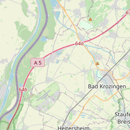
| Centre Point | 47.9531483,7.755841 |
| OSM | way 27198269 |
| Computed Postcode | 79227 |
| Address Tags | |
| Extra Tags | no (oneway)
grade4 (tracktype)
|
| Local name | Type | OSM | Address rank | Admin level | Distance | |
| Im Batzenberg | highway:track | way 27198269 | 26 | 0 | details > | |
| Herrengarten | place:neighbourhood | node 2798381516 | 22 | 0 | details > | |
| Kaiserstuhl | place:neighbourhood | node 2812421837 | 22 | 0 | details > | |
| Hinterdorf | place:neighbourhood | node 2798381517 | 22 | 0 | details > | |
| Unterdorf | place:neighbourhood | node 2798381534 | 22 | 0 | details > | |
| Kritt | place:neighbourhood | node 2812418496 | 22 | 0 | details > | |
| Schallstadt (Kernort) | boundary:administrative | relation 70110 | 20 | 10 | 0 | details > |
| Wolfenweiler | boundary:administrative | relation 70108 | 20 | 10 | 0 | details > |
| Schallstadt | place:town | relation 1946216 | 16 | 8 | 0 | details > |
| VVG der Gemeinde Schallstadt | boundary:administrative | relation 1946221 | 14 | 7 | 0 | details > |
| Landkreis Breisgau-Hochschwarzwald | boundary:administrative | relation 1946367 | 12 | 6 | 0 | details > |
| Regierungsbezirk Freiburg | boundary:administrative | relation 2106112 | 10 | 5 | 0 | details > |
| Baden-Württemberg | place:state | relation 62611 | 8 | 4 | ~1 m | details > |
| 79227 | place:postcode | 5 | 0 | |||
| 79227 | place:postcode | relation 3361755 | 5 | 0 | details > | |
| Deutschland | place:country | relation 51477 | 4 | 2 | ~4 m | details > |
| de | place:country_code | 4 | 0 | |||
Parent Of | ||||||
Boundary_stone | ||||||
| No Name | historic:boundary_stone | node 300099600 | 30 | ~494 m | details > | |
| No Name | historic:boundary_stone | node 300099598 | 30 | ~541 m | details > | |
| No Name | historic:boundary_stone | node 300099617 | 30 | ~142 m | details > | |
| No Name | historic:boundary_stone | node 939370452 | 30 | ~121 m | details > | |
| No Name | historic:boundary_stone | node 300099595 | 30 | ~545 m | details > | |
| No Name | historic:boundary_stone | node 300099613 | 30 | ~39 m | details > | |
Shelter | ||||||
| No Name | amenity:shelter | node 319081058 | 30 | ~198 m | details > | |