| Name | Törring (name)
|
| Type | place:village |
| Last Updated | 2018-12-03 17:50 |
| Admin Level | 15 |
| Rank | Other: 19 |
| Importance | 0.275 (estimated) |
| Coverage | Polygon |
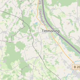
| Centre Point | 48.0070554,12.7486078 |
| OSM | way 30729438 |
| Computed Postcode | |
| Address Tags | |
| Extra Tags | village (place)
|
| Local name | Type | OSM | Address rank | Admin level | Distance | |
| Törring | place:village | way 30729438 | 16 | 0 | details > | |
| Tittmoning | place:town | relation 941656 | 16 | 8 | 0 | details > |
| Landkreis Traunstein | boundary:administrative | relation 2156363 | 12 | 6 | 0 | details > |
| Obb | boundary:administrative | relation 2145274 | 10 | 5 | 0 | details > |
| Bayern | place:state | relation 2145268 | 8 | 4 | ~2 m | details > |
| Deutschland | place:country | relation 51477 | 4 | 2 | ~4 m | details > |
| de | place:country_code | 4 | 0 | |||
Linked Places | ||||||
| Törring | place:village | node 3894267258 | 16 | 0 | details > | |
Parent Of | ||||||
Residential | ||||||
| Bachweg | highway:residential | way 33939656 | 26 | ~90 m | details > | |
| Bachweg | highway:residential | way 33939626 | 26 | ~209 m | details > | |
| Bergfeld | highway:residential | way 30729437 | 26 | ~140 m | details > | |
| Bergfeld | highway:residential | way 34881938 | 26 | ~123 m | details > | |
| Dorfplatz | highway:residential | way 34882039 | 26 | ~14 m | details > | |
| Dorfplatz | highway:residential | way 171382438 | 26 | ~34 m | details > | |
| Dorfplatz | highway:residential | way 30729436 | 26 | ~93 m | details > | |
| Dorfplatz | highway:residential | way 33939673 | 26 | ~8 m | details > | |
| Graf-Törring-Straße | highway:residential | way 26442085 | 26 | ~107 m | details > | |
| Großwinklerweg | highway:residential | way 34882010 | 26 | ~33 m | details > | |
| Schmiedbergstraße | highway:residential | way 30729430 | 26 | ~107 m | details > | |
| Seerosenweg | highway:residential | way 33907347 | 26 | ~234 m | details > | |
| Seestraße | highway:residential | way 34904816 | 26 | ~140 m | details > | |
| Wiesenweg | highway:residential | way 33939645 | 26 | ~137 m | details > | |
Unclassified | ||||||
| Graf-Törring-Straße | highway:unclassified | way 33907307 | 26 | ~158 m | details > | |