| Name | Kinder-Waldlehrpfad (name)
|
| Type | highway:path |
| Last Updated | 2018-12-05 15:46 |
| Admin Level | 15 |
| Rank | Minory Street / Path |
| Importance | 0.075 (estimated) |
| Coverage | Point |
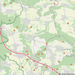
| Centre Point | 48.8334675,8.8905908 |
| OSM | way 33189798 |
| Computed Postcode | 71287 |
| Address Tags | |
| Extra Tags | no (motor_vehicle)
gravel (surface)
1.5 (width)
|
| Local name | Type | OSM | Address rank | Admin level | Distance | |
| Kinder-Waldlehrpfad | highway:path | way 33189798 | 27 | 0 | details > | |
| Perouse | place:suburb | node 60889577 | 20 | 9 | 0 | details > |
| Mittelberg | place:isolated_dwelling | node 4718694248 | 20 | 0 | details > | |
| Weissach | place:village | relation 722149 | 16 | 8 | 0 | details > |
| Landkreis Böblingen | boundary:administrative | relation 62721 | 12 | 6 | 0 | details > |
| Regierungsbezirk Stuttgart | boundary:administrative | relation 22041 | 10 | 5 | 0 | details > |
| Baden-Württemberg | place:state | relation 62611 | 8 | 4 | 0 | details > |
| 71287 | place:postcode | 5 | 0 | |||
| 71287 | place:postcode | relation 3378005 | 5 | 0 | details > | |
| Deutschland | place:country | relation 51477 | 4 | 2 | ~3 m | details > |
| de | place:country_code | 4 | 0 | |||
Parent Of | ||||||
Hunting_stand | ||||||
| No Name | amenity:hunting_stand | node 2344321957 | 30 | ~490 m | details > | |
Bench | ||||||
| No Name | amenity:bench | node 1757655315 | 30 | ~488 m | details > | |
| No Name | amenity:bench | node 769046558 | 30 | ~238 m | details > | |