| Name | Straße D (name)
|
| Type | highway:residential |
| Last Updated | 2018-12-04 02:53 |
| Admin Level | 15 |
| Rank | Street / Major Landmark |
| Importance | 0.1 (estimated) |
| Coverage | Point |
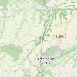
| Centre Point | 48.1796275,12.7276858 |
| OSM | way 34690804 |
| Computed Postcode | 84508 |
| Address Tags | |
| Extra Tags |
| Local name | Type | OSM | Address rank | Admin level | Distance | |
| Straße D | highway:residential | way 34690804 | 26 | 0 | details > | |
| Gendorf | place:suburb | node 367602255 | 20 | 0 | details > | |
| Bonauer | place:isolated_dwelling | node 2269837921 | 20 | 0 | details > | |
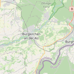
| Burgkirchen an der Alz | place:town | relation 942047 | 16 | 8 | 0 | details > |
| Lohner | place:hamlet | node 2595500456 | 16 | 0 | details > | |
| Schachen | place:hamlet | node 2267919402 | 16 | 0 | details > | |
| Aichpoint | place:hamlet | node 2267919401 | 16 | 0 | details > | |
| Bruck | place:hamlet | node 114142070 | 16 | 0 | details > | |
| Landkreis Altötting | boundary:administrative | relation 62663 | 12 | 6 | 0 | details > |
| Obb | boundary:administrative | relation 2145274 | 10 | 5 | 0 | details > |
| Bayern | place:state | relation 2145268 | 8 | 4 | ~2 m | details > |
| 84508 | place:postcode | 5 | 0 | |||
| 84508 | place:postcode | relation 1120207 | 5 | 0 | details > | |
| Deutschland | place:country | relation 51477 | 4 | 2 | ~4 m | details > |
| de | place:country_code | 4 | 0 | |||
Parent Of | ||||||
Office | ||||||
| 118 | office:yes | way 315216269 | 30 | ~256 m | details > | |
| 414 | office:yes | way 315216283 | 30 | ~454 m | details > | |
Building | ||||||
| 171 | building:yes | way 315216277 | 30 | ~208 m | details > | |
| 213 | building:yes | way 374687895 | 30 | ~39 m | details > | |
| 320 | building:yes | way 182822728 | 30 | ~353 m | details > | |
| 400 | building:yes | way 435898851 | 30 | ~228 m | details > | |
Works | ||||||
| Chemiepark Gendorf | man_made:works | relation 2647987 | 30 | ~355 m | details > | |