| Name | Unterhausen (name)
|
| Type | place:village |
| Last Updated | 2018-12-03 18:03 |
| Admin Level | 15 |
| Rank | Other: 19 |
| Importance | 0.275 (estimated) |
| Coverage | Polygon |
| Centre Point | 47.8619364,11.1522544 |
| OSM | way 35470963 |
| Computed Postcode | 82362 |
| Address Tags | 82362 (postcode)
|
| Extra Tags | village (place)
|
| Local name | Type | OSM | Address rank | Admin level | Distance | |
| Unterhausen | place:village | way 35470963 | 16 | 0 | details > | |
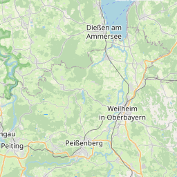
| Weilheim in Oberbayern | place:town | relation 936925 | 16 | 8 | 0 | details > |
| Landkreis Weilheim-Schongau | boundary:administrative | relation 62600 | 12 | 6 | 0 | details > |
| Obb | boundary:administrative | relation 2145274 | 10 | 5 | 0 | details > |
| Bayern | place:state | relation 2145268 | 8 | 4 | ~1 m | details > |
| 82362 | place:postcode | 5 | 0 | |||
| Deutschland | place:country | relation 51477 | 4 | 2 | ~4 m | details > |
| de | place:country_code | 4 | 0 | |||
Linked Places | ||||||
| Unterhausen | place:village | node 274954491 | 16 | 0 | details > | |
Parent Of | ||||||
Residential | ||||||
| Am Anger | highway:residential | way 24893713 | 26 | ~408 m | details > | |
| Am Anger | highway:residential | way 24893712 | 26 | ~272 m | details > | |
| Berndorferweg | highway:residential | way 24893716 | 26 | ~344 m | details > | |
| Berndorferweg | highway:residential | way 90508585 | 26 | ~319 m | details > | |
| Dorfstraße | highway:residential | way 25415431 | 26 | ~9 m | details > | |
| Ignaz-Manz-Straße | highway:residential | way 25379207 | 26 | ~494 m | details > | |
| Im Kirchwinkl | highway:residential | way 147478443 | 26 | ~9 m | details > | |
| Johannes-Michel-Weg | highway:residential | way 44590089 | 26 | ~372 m | details > | |
| Kapellenstraße | highway:residential | way 411721326 | 26 | ~426 m | details > | |
| Kapellenstraße | highway:residential | way 90508124 | 26 | ~135 m | details > | |
| Kohlwinklstraße | highway:residential | way 25379202 | 26 | ~232 m | details > | |
| Kohlwinklstraße | highway:residential | way 25379203 | 26 | ~295 m | details > | |
| Martin-Raith-Straße | highway:residential | way 411721330 | 26 | ~420 m | details > | |
| Martin-Raith-Straße | highway:residential | way 24893718 | 26 | ~426 m | details > | |
| Schlossengriesstraße | highway:residential | way 24893714 | 26 | ~231 m | details > | |
| Schlossengriesstraße | highway:residential | way 25379209 | 26 | ~167 m | details > | |
| Schondorferstraße | highway:residential | way 24893717 | 26 | ~380 m | details > | |
| Serbastian-Andre-Weg | highway:residential | way 25379208 | 26 | ~337 m | details > | |
| Sigemariweg | highway:residential | way 25379205 | 26 | ~561 m | details > | |
| Sportplatzweg | highway:residential | way 25379226 | 26 | ~205 m | details > | |
| Sportplatzweg | highway:residential | way 25379227 | 26 | ~281 m | details > | |
| Unterhausener Straße | highway:residential | way 25379214 | 26 | ~520 m | details > | |
Unclassified | ||||||
| Dorfstraße | highway:unclassified | way 411721323 | 26 | ~208 m | details > | |
| Dorfstraße | highway:unclassified | way 147478441 | 26 | ~21 m | details > | |
| Dorfstraße | highway:unclassified | way 25379211 | 26 | ~274 m | details > | |
| Raistinger Straße | highway:unclassified | way 25379215 | 26 | ~16 m | details > | |
| Unterhausener Straße | highway:unclassified | way 25379213 | 26 | ~208 m | details > | |
| Unterhausener Straße | highway:unclassified | way 411721336 | 26 | ~486 m | details > | |
| Unterhausener Straße | highway:unclassified | way 147371317 | 26 | ~233 m | details > | |