| Name | Horkheimer Straße (name)
Horkheimer Straße (name:de)
K 9554 (ref)
|
| Type | highway:tertiary |
| Last Updated | 2018-12-04 18:40 |
| Admin Level | 15 |
| Rank | Street / Major Landmark |
| Importance | 0.1 (estimated) |
| Coverage | Point |
| Centre Point | 49.118494,9.1829156 |
| OSM | way 38940757 |
| Computed Postcode | 74081 |
| Address Tags | |
| Extra Tags | 50 (maxspeed)
asphalt (surface)
|
| Local name | Type | OSM | Address rank | Admin level | Distance | |
| Horkheimer Straße | highway:tertiary | way 38940757 | 26 | 0 | details > | |
| Alt-Böckingen | place:neighbourhood | node 2626882430 | 22 | 0 | details > | |
| Sontheim | place:suburb | node 1564935149 | 20 | 0 | details > | |
| Horkheim | boundary:administrative | relation 3318347 | 18 | 9 | 0 | details > |
| Sontheim | boundary:administrative | relation 3318351 | 18 | 9 | 0 | details > |
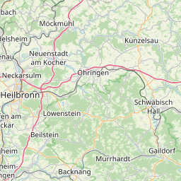
| Heilbronn | place:city | node 26769661 | 16 | 0 | details > | |
| Linsenbuckel | place:hamlet | node 2313639502 | 16 | 0 | details > | |
| Haigern | place:hamlet | node 268850442 | 16 | 0 | details > | |
| Heilbronn | boundary:administrative | relation 62751 | 12 | 6 | 0 | details > |
| Regierungsbezirk Stuttgart | boundary:administrative | relation 22041 | 10 | 5 | 0 | details > |
| Baden-Württemberg | place:state | relation 62611 | 8 | 4 | 0 | details > |
| 74081 | place:postcode | 5 | 0 | |||
| 74081 | place:postcode | relation 1227790 | 5 | 0 | details > | |
| Deutschland | place:country | relation 51477 | 4 | 2 | ~2 m | details > |
| de | place:country_code | 4 | 0 | |||
Parent Of | ||||||
Information | ||||||
| Tourist Information Heilbronn | tourism:information | node 894227738 | 30 | ~180 m | details > | |
Pitch | ||||||
| No Name | leisure:pitch | way 99468568 | 30 | ~94 m | details > | |