| Name | Staschwitz (name)
|
| Type | landuse:residential |
| Last Updated | 2018-12-03 19:51 |
| Admin Level | 15 |
| Rank | Croft / Farm / Locality / Islet |
| Importance | 0.2 (estimated) |
| Coverage | Polygon |
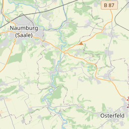
| Centre Point | 51.07640885,12.2523559784117 |
| OSM | way 41593558 |
| Computed Postcode | 06729 |
| Address Tags | |
| Extra Tags |
| Local name | Type | OSM | Address rank | Admin level | Distance | |
| Staschwitz | landuse:residential | way 41593558 | 22 | 0 | details > | |
| Langendorf | boundary:administrative | relation 2405011 | 20 | 10 | 0 | details > |
| Elsteraue | boundary:administrative | relation 2404585 | 16 | 8 | 0 | details > |
| Staschwitz | place:village | node 2095185055 | 16 | 0 | details > | |
| Döbitzschen | place:village | node 2095191416 | 16 | 0 | details > | |
| Langendorf | place:village | node 240099764 | 16 | 0 | details > | |
| Burgenlandkreis | place:county | relation 62639 | 12 | 6 | 0 | details > |
| Sachsen-Anhalt | place:state | relation 62607 | 8 | 4 | ~1 m | details > |
| 06729 | place:postcode | 5 | 0 | |||
| 06729 | place:postcode | relation 2405006 | 5 | 0 | details > | |
| Deutschland | place:country | relation 51477 | 4 | 2 | ~2 m | details > |
| de | place:country_code | 4 | 0 | |||
Parent Of | ||||||
Residential | ||||||
| Am Teich | highway:residential | way 41591587 | 26 | 0 | details > | |
| Am Teich | highway:residential | way 41591588 | 26 | ~38 m | details > | |
| Am Teich | highway:residential | way 39442986 | 26 | ~34 m | details > | |
| Artur-Klötzner-Straße | highway:residential | way 39442980 | 26 | ~80 m | details > | |
| Siedlung | highway:residential | way 39442985 | 26 | ~95 m | details > | |
| Staschwitzer Hauptstraße | highway:residential | way 41591591 | 26 | ~198 m | details > | |
| Staschwitzer Hauptstraße | highway:residential | way 39442975 | 26 | ~143 m | details > | |
Secondary | ||||||
| L 192 | highway:secondary | way 41593646 | 26 | ~253 m | details > | |
| Staschwitzer Hauptstraße | highway:secondary | way 538177013 | 26 | ~103 m | details > | |
| Staschwitzer Hauptstraße | highway:secondary | way 538177012 | 26 | ~64 m | details > | |
| Staschwitzer Hauptstraße | highway:secondary | way 39442972 | 26 | ~80 m | details > | |