| Name | Hochstiegweg (name)
|
| Type | highway:track |
| Last Updated | 2018-12-05 03:19 |
| Admin Level | 15 |
| Rank | Street / Major Landmark |
| Importance | 0.1 (estimated) |
| Coverage | Point |
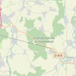
| Centre Point | 48.0234513,7.9211795 |
| OSM | way 42945935 |
| Computed Postcode | 79286 |
| Address Tags | |
| Extra Tags | ground (surface)
grade3 (tracktype)
2.5 (width)
|
| Local name | Type | OSM | Address rank | Admin level | Distance | |
| Hochstiegweg | highway:track | way 42945935 | 26 | 0 | details > | |
| Attental | place:neighbourhood | node 2968154706 | 22 | 0 | details > | |
| Föhrental | boundary:administrative | relation 70208 | 20 | 10 | 0 | details > |
| Glottertal | place:village | relation 70202 | 16 | 8 | 0 | details > |
| Föhrental | place:hamlet | node 257468614 | 16 | 0 | details > | |
| Obertal | place:hamlet | node 3240740754 | 16 | 0 | details > | |
| GVV St. Peter | boundary:administrative | relation 308235 | 14 | 7 | 0 | details > |
| Landkreis Breisgau-Hochschwarzwald | boundary:administrative | relation 1946367 | 12 | 6 | 0 | details > |
| Regierungsbezirk Freiburg | boundary:administrative | relation 2106112 | 10 | 5 | 0 | details > |
| Baden-Württemberg | place:state | relation 62611 | 8 | 4 | ~1 m | details > |
| 79286 | place:postcode | 5 | 0 | |||
| 79286 | place:postcode | relation 3372342 | 5 | 0 | details > | |
| Deutschland | place:country | relation 51477 | 4 | 2 | ~4 m | details > |
| de | place:country_code | 4 | 0 | |||
Parent Of | ||||||
Hunting_stand | ||||||
| No Name | amenity:hunting_stand | node 5096250698 | 30 | ~277 m | details > | |