| Name | Gerstland (name)
|
| Type | highway:service |
| Last Updated | 2018-12-05 13:38 |
| Admin Level | 15 |
| Rank | Minory Street / Path |
| Importance | 0.075 (estimated) |
| Coverage | Point |
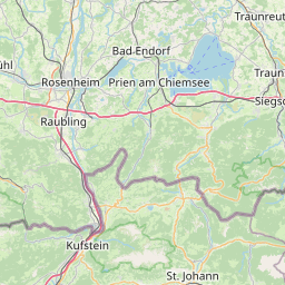
| Centre Point | 47.7419526,12.1992968 |
| OSM | way 43624472 |
| Computed Postcode | 83122 |
| Address Tags | |
| Extra Tags | 10% (incline)
good (smoothness)
paving_stones (surface)
3.5 (width)
|
| Local name | Type | OSM | Address rank | Admin level | Distance | |
| Gerstland | highway:service | way 43624472 | 27 | 0 | details > | |
| Samerberg | place:village | relation 2186939 | 16 | 8 | 0 | details > |
| Gritschen | place:hamlet | node 1557550166 | 16 | 0 | details > | |
| Riedalm | place:hamlet | node 3518236365 | 16 | 0 | details > | |
| Brennbichl | place:hamlet | node 1557680256 | 16 | 0 | details > | |
| Ried im Winkel | place:hamlet | node 1560440134 | 16 | 0 | details > | |
| Gritschen | place:hamlet | node 1557668589 | 16 | 0 | details > | |
| Gern | place:hamlet | node 1561632896 | 16 | 0 | details > | |
| Schweibern | place:hamlet | node 1558649953 | 16 | 0 | details > | |
| Gerstland | place:hamlet | node 1557550163 | 16 | 0 | details > | |
| Landkreis Rosenheim | place:county | relation 2156362 | 12 | 6 | 0 | details > |
| Obb | boundary:administrative | relation 2145274 | 10 | 5 | 0 | details > |
| Bayern | place:state | relation 2145268 | 8 | 4 | ~1 m | details > |
| 83122 | place:postcode | 5 | 0 | |||
| 83122 | place:postcode | relation 1114583 | 5 | 0 | details > | |
| Deutschland | place:country | relation 51477 | 4 | 2 | ~4 m | details > |
| de | place:country_code | 4 | 0 | |||
Parent Of | ||||||
Building | ||||||
| Künstlerhäuschen | building:yes | way 178696166 | 30 | ~74 m | details > | |
| No Name | building:yes | way 178696164 | 30 | ~39 m | details > | |
Hunting_stand | ||||||
| No Name | amenity:hunting_stand | node 3518236724 | 30 | ~285 m | details > | |
Information | ||||||
| No Name | tourism:information | node 3518236753 | 30 | ~84 m | details > | |