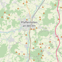
| Name | Gewerbegebiet Kuglhof (name)
|
| Type | landuse:commercial |
| Last Updated | 2018-12-03 19:53 |
| Admin Level | 15 |
| Rank | Croft / Farm / Locality / Islet |
| Importance | 0.2 (estimated) |
| Coverage | Polygon |
| Centre Point | 48.5236347,11.5360391076049 |
| OSM | way 45743029 |
| Computed Postcode | 85276 |
| Address Tags | Pfaffenhofen an der Ilm (city)
85276 (postcode)
Äußere Moosburger Straße (street)
|
| Extra Tags |
| Local name | Type | OSM | Address rank | Admin level | Distance | |
| Gewerbegebiet Kuglhof | landuse:commercial | way 45743029 | 22 | 0 | details > | |
| Eberstetten | place:suburb | node 25530685 | 20 | 0 | details > | |
| Pfaffenhofen an der Ilm | place:town | relation 396556 | 16 | 8 | 0 | details > |
| Kuglhof | place:hamlet | node 582484174 | 16 | 0 | details > | |
| Zweckhof | place:hamlet | node 731301362 | 16 | 0 | details > | |
| Ehrensberg | place:hamlet | node 581822112 | 16 | 0 | details > | |
| Prambach | place:hamlet | node 544861454 | 16 | 0 | details > | |
| Leiten | place:hamlet | node 581885989 | 16 | 0 | details > | |
| Landkreis Pfaffenhofen an der Ilm | boundary:administrative | relation 62371 | 12 | 6 | 0 | details > |
| Pfaffenhofen an der Ilm | place:county | node 240053868 | 12 | 0 | details > | |
| Obb | boundary:administrative | relation 2145274 | 10 | 5 | 0 | details > |
| Bayern | place:state | relation 2145268 | 8 | 4 | 0 | details > |
| 85276 | place:postcode | 5 | 0 | |||
| 85276 | place:postcode | relation 1096930 | 5 | 0 | details > | |
| Deutschland | place:country | relation 51477 | 4 | 2 | ~3 m | details > |
| de | place:country_code | 4 | 0 | |||
Parent Of | ||||||
Unclassified | ||||||
| Färberstraße | highway:unclassified | way 4246349 | 26 | ~77 m | details > | |
| Lebzelterstraße | highway:unclassified | way 4246346 | 26 | ~190 m | details > | |
| Ledererstraße | highway:unclassified | way 378307494 | 26 | ~64 m | details > | |
| Ledererstraße | highway:unclassified | way 4246345 | 26 | ~118 m | details > | |
| Schäfflerstraße | highway:unclassified | way 4246347 | 26 | ~145 m | details > | |
| Schäfflerstraße | highway:unclassified | way 378305610 | 26 | ~253 m | details > | |
Proposed | ||||||
| St 2045 | highway:proposed | way 403098712 | 26 | ~365 m | details > | |
Tertiary | ||||||
| Äußere Moosburger Straße | highway:tertiary | way 378293339 | 26 | ~495 m | details > | |
| Äußere Moosburger Straße | highway:tertiary | way 4246385 | 26 | ~282 m | details > | |
Construction | ||||||
| No Name | highway:construction | way 637436846 | 26 | ~202 m | details > | |
| No Name | highway:construction | way 588918873 | 26 | ~217 m | details > | |