| Name | Stöttham (name)
|
| Type | place:village |
| Last Updated | 2018-12-03 17:50 |
| Admin Level | 15 |
| Rank | Other: 19 |
| Importance | 0.275 (estimated) |
| Coverage | Polygon |
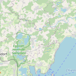
| Centre Point | 47.9049199,12.5240582 |
| OSM | way 46838150 |
| Computed Postcode | |
| Address Tags | |
| Extra Tags | hamlet (place)
|
| Local name | Type | OSM | Address rank | Admin level | Distance | |
| Stöttham | place:village | way 46838150 | 16 | 0 | details > | |
| Chieming | place:village | relation 941738 | 16 | 8 | 0 | details > |
| Landkreis Traunstein | boundary:administrative | relation 2156363 | 12 | 6 | 0 | details > |
| Obb | boundary:administrative | relation 2145274 | 10 | 5 | 0 | details > |
| Bayern | place:state | relation 2145268 | 8 | 4 | ~2 m | details > |
| Deutschland | place:country | relation 51477 | 4 | 2 | ~4 m | details > |
| de | place:country_code | 4 | 0 | |||
Linked Places | ||||||
| Stöttham | place:hamlet | node 257422515 | 16 | 0 | details > | |
Parent Of | ||||||
Residential | ||||||
| Beim Seehäusl | highway:residential | way 37693085 | 26 | ~366 m | details > | |
| Bergmoosstraße | highway:residential | way 27046406 | 26 | ~30 m | details > | |
| Bergmoosstraße | highway:residential | way 478481059 | 26 | ~56 m | details > | |
| Bergmoosstraße | highway:residential | way 27046405 | 26 | ~56 m | details > | |
| Bergmoosstraße | highway:residential | way 478481058 | 26 | ~46 m | details > | |
| Chiemingerstraße | highway:residential | way 27046607 | 26 | ~150 m | details > | |
| Chiemingerstraße | highway:residential | way 478481062 | 26 | ~150 m | details > | |
| Chiemingerstraße | highway:residential | way 478481066 | 26 | ~153 m | details > | |
| Dorfstraße | highway:residential | way 27045867 | 26 | ~167 m | details > | |
| Dorfstraße | highway:residential | way 27045872 | 26 | ~192 m | details > | |
| Dorfstraße | highway:residential | way 27046319 | 26 | ~67 m | details > | |
| Dorfstraße | highway:residential | way 39325906 | 26 | ~168 m | details > | |
| Dorfstraße | highway:residential | way 478481130 | 26 | ~169 m | details > | |
| Dorfstraße | highway:residential | way 334335091 | 26 | ~154 m | details > | |
| Dorfstraße | highway:residential | way 39325914 | 26 | ~192 m | details > | |
| Dorfäcker | highway:residential | way 46838142 | 26 | ~197 m | details > | |
| Schützing | highway:residential | way 27046874 | 26 | ~227 m | details > | |
| Sonnenstraße | highway:residential | way 27046347 | 26 | ~166 m | details > | |
| Steinheilstraße | highway:residential | way 31050376 | 26 | ~197 m | details > | |
| Weinbergstraße | highway:residential | way 27046379 | 26 | ~37 m | details > | |
| No Name | highway:residential | way 46838140 | 26 | ~321 m | details > | |
Unclassified | ||||||
| Isinger Straße | highway:unclassified | way 24382000 | 26 | ~83 m | details > | |
| Isinger Straße | highway:unclassified | way 478481116 | 26 | ~69 m | details > | |
| Isinger Straße | highway:unclassified | way 478481118 | 26 | ~185 m | details > | |
| Isinger Straße | highway:unclassified | way 478481119 | 26 | ~99 m | details > | |
| No Name | highway:unclassified | way 23760083 | 26 | ~249 m | details > | |