| Name | Brunnhausgasse (name)
|
| Type | highway:residential |
| Last Updated | 2018-12-04 02:51 |
| Admin Level | 15 |
| Rank | Street / Major Landmark |
| Importance | 0.1 (estimated) |
| Coverage | Point |
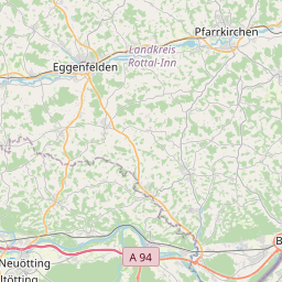
| Centre Point | 48.2415285,12.6901537 |
| OSM | way 48145714 |
| Computed Postcode | 84524 |
| Address Tags | |
| Extra Tags | asphalt (surface)
2 (width)
|
| Local name | Type | OSM | Address rank | Admin level | Distance | |
| Brunnhausgasse | highway:residential | way 48145714 | 26 | 0 | details > | |
| Rubenberg | place:isolated_dwelling | node 2397024572 | 20 | 0 | details > | |
| Feldhütter | place:isolated_dwelling | node 2282752347 | 20 | 0 | details > | |
| Neuötting | place:town | relation 942028 | 16 | 8 | 0 | details > |
| Pfaffenöd | place:hamlet | node 2216194113 | 16 | 0 | details > | |
| Lehneck | place:hamlet | node 2267942622 | 16 | 0 | details > | |
| Sankt Johann | place:hamlet | node 2282753785 | 16 | 0 | details > | |
| Burg | place:hamlet | node 1428587441 | 16 | 0 | details > | |
| Harrer am Holz | place:hamlet | node 2267943502 | 16 | 0 | details > | |
| Riedergütl | place:hamlet | node 2282753192 | 16 | 0 | details > | |
| Loha | place:hamlet | node 2267943501 | 16 | 0 | details > | |
| Ortmairgütl | place:hamlet | node 2216194112 | 16 | 0 | details > | |
| Kronberg | place:hamlet | node 276624892 | 16 | 0 | details > | |
| Sankt Johann | place:hamlet | node 2218310055 | 16 | 0 | details > | |
| Unterau | place:village | node 1428587539 | 16 | 0 | details > | |
| Eisenfelden | place:village | node 1428587442 | 16 | 0 | details > | |
| Landkreis Altötting | boundary:administrative | relation 62663 | 12 | 6 | 0 | details > |
| Obb | boundary:administrative | relation 2145274 | 10 | 5 | 0 | details > |
| Bayern | place:state | relation 2145268 | 8 | 4 | ~1 m | details > |
| 84524 | place:postcode | 5 | 0 | |||
| 84524 | place:postcode | relation 1120213 | 5 | 0 | details > | |
| Deutschland | place:country | relation 51477 | 4 | 2 | ~4 m | details > |
| de | place:country_code | 4 | 0 | |||
Parent Of | ||||||
Building | ||||||
| No Name | building:yes | way 403128092 | 30 | ~13 m | details > | |
| No Name | building:yes | way 403182329 | 30 | ~28 m | details > | |
| No Name | building:yes | way 403128097 | 30 | ~5 m | details > | |