| Name | TS 1 (ref)
|
| Type | highway:tertiary |
| Last Updated | 2018-12-04 02:51 |
| Admin Level | 15 |
| Rank | Street / Major Landmark |
| Importance | 0.1 (estimated) |
| Coverage | Point |
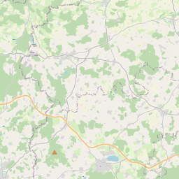
| Centre Point | 48.0440724,12.6593243 |
| OSM | way 48825786 |
| Computed Postcode | 83349 |
| Address Tags | |
| Extra Tags | 100 (maxspeed)
|
| Local name | Type | OSM | Address rank | Admin level | Distance | |
| TS 1 | highway:tertiary | way 48825786 | 26 | 0 | details > | |
| Meggenthal | place:isolated_dwelling | node 269769819 | 20 | 0 | details > | |
| Palling | place:village | relation 941652 | 16 | 8 | 0 | details > |
| Heilham | place:hamlet | node 269771968 | 16 | 0 | details > | |
| Schreckenbach | place:hamlet | node 411567386 | 16 | 0 | details > | |
| Beharting | place:hamlet | node 411567205 | 16 | 0 | details > | |
| Loding | place:hamlet | node 269769822 | 16 | 0 | details > | |
| Freutsmoos | place:village | node 269771953 | 16 | 0 | details > | |
| Emmering | place:hamlet | node 1423178943 | 16 | 0 | details > | |
| Landkreis Traunstein | boundary:administrative | relation 2156363 | 12 | 6 | 0 | details > |
| Obb | boundary:administrative | relation 2145274 | 10 | 5 | 0 | details > |
| Bayern | place:state | relation 2145268 | 8 | 4 | ~2 m | details > |
| 83349 | place:postcode | 5 | 0 | |||
| 83349 | place:postcode | relation 1114723 | 5 | 0 | details > | |
| Deutschland | place:country | relation 51477 | 4 | 2 | ~4 m | details > |
| de | place:country_code | 4 | 0 |