| Name | Hans-Joos-Straße (name)
|
| Type | highway:footway |
| Last Updated | 2018-12-05 16:49 |
| Admin Level | 15 |
| Rank | Minory Street / Path |
| Importance | 0.075 (estimated) |
| Coverage | Point |
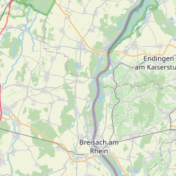
| Centre Point | 47.9575666,7.7542865 |
| OSM | way 50754454 |
| Computed Postcode | 79227 |
| Address Tags | 79227 (postcode)
|
| Extra Tags | asphalt (surface)
|
| Local name | Type | OSM | Address rank | Admin level | Distance | |
| Hans-Joos-Straße | highway:footway | way 50754454 | 27 | 0 | details > | |
| Herrengarten | place:neighbourhood | node 2798381516 | 22 | 0 | details > | |
| Kaiserstuhl | place:neighbourhood | node 2812421837 | 22 | 0 | details > | |
| Hinterdorf | place:neighbourhood | node 2798381517 | 22 | 0 | details > | |
| Unterdorf | place:neighbourhood | node 2798381534 | 22 | 0 | details > | |
| Schallstadt (Kernort) | boundary:administrative | relation 70110 | 20 | 10 | 0 | details > |
| Schallstadt | place:town | relation 1946216 | 16 | 8 | 0 | details > |
| VVG der Gemeinde Schallstadt | boundary:administrative | relation 1946221 | 14 | 7 | 0 | details > |
| Landkreis Breisgau-Hochschwarzwald | boundary:administrative | relation 1946367 | 12 | 6 | 0 | details > |
| Regierungsbezirk Freiburg | boundary:administrative | relation 2106112 | 10 | 5 | 0 | details > |
| Baden-Württemberg | place:state | relation 62611 | 8 | 4 | ~1 m | details > |
| 79227 | place:postcode | 5 | 0 | |||
| 79227 | place:postcode | relation 3361755 | 5 | 0 | details > | |
| Deutschland | place:country | relation 51477 | 4 | 2 | ~4 m | details > |
| de | place:country_code | 4 | 0 |