| Name | Bahnhofstraße (name)
|
| Type | highway:residential |
| Last Updated | 2018-12-04 10:52 |
| Admin Level | 15 |
| Rank | Street / Major Landmark |
| Importance | 0.1 (estimated) |
| Coverage | Point |
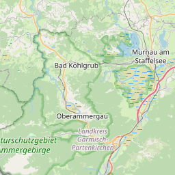
| Centre Point | 47.6676028,11.0580824 |
| OSM | way 50773289 |
| Computed Postcode | 82433 |
| Address Tags | |
| Extra Tags | paved (surface)
|
| Local name | Type | OSM | Address rank | Admin level | Distance | |
| Bahnhofstraße | highway:residential | way 50773289 | 26 | 0 | details > | |
| Kappellaine | place:isolated_dwelling | node 5431995722 | 20 | 0 | details > | |
| Bad Kohlgrub | place:town | relation 937894 | 16 | 8 | 0 | details > |
| Steigrain | place:village | node 1724649559 | 16 | 0 | details > | |
| Wäldle | place:hamlet | node 1724649613 | 16 | 0 | details > | |
| Landkreis Garmisch-Partenkirchen | boundary:administrative | relation 62726 | 12 | 6 | 0 | details > |
| Obb | boundary:administrative | relation 2145274 | 10 | 5 | 0 | details > |
| Bayern | place:state | relation 2145268 | 8 | 4 | ~1 m | details > |
| 82433 | place:postcode | 5 | 0 | |||
| 82433 | place:postcode | relation 1109071 | 5 | 0 | details > | |
| Deutschland | place:country | relation 51477 | 4 | 2 | ~4 m | details > |
| de | place:country_code | 4 | 0 | |||
Parent Of | ||||||
Building | ||||||
| No Name | building:yes | way 505402622 | 30 | ~23 m | details > | |
| No Name | building:yes | way 243903595 | 30 | ~52 m | details > | |
| No Name | building:yes | way 140744910 | 30 | ~16 m | details > | |
| No Name | building:yes | way 561082086 | 30 | ~34 m | details > | |
| No Name | building:yes | way 561082087 | 30 | ~20 m | details > | |
| No Name | building:yes | way 243903683 | 30 | ~11 m | details > | |