| Name | Ludwig-Lohner-Straße (name)
|
| Type | highway:tertiary |
| Last Updated | 2018-12-04 21:50 |
| Admin Level | 15 |
| Rank | Street / Major Landmark |
| Importance | 0.1 (estimated) |
| Coverage | Point |
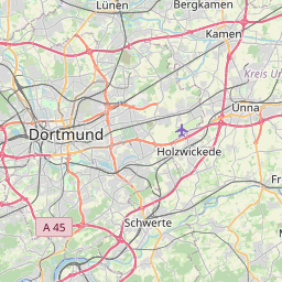
| Centre Point | 51.508174,7.5328859 |
| OSM | way 52908061 |
| Computed Postcode | 44143 |
| Address Tags | |
| Extra Tags | 1 (lanes)
50 (maxspeed)
yes (oneway)
asphalt (surface)
|
| Local name | Type | OSM | Address rank | Admin level | Distance | |
| Ludwig-Lohner-Straße | highway:tertiary | way 52908061 | 26 | 0 | details > | |
| Wambel | place:suburb | node 3946689449 | 20 | 0 | details > | |
| Schüren | place:suburb | node 299440226 | 20 | 0 | details > | |
| Brackel | place:suburb | node 146941620 | 20 | 0 | details > | |
| Dortmund | place:city | node 25293125 | 16 | 0 | details > | |
| Dortmund | boundary:administrative | relation 1829065 | 12 | 6 | 0 | details > |
| Regierungsbezirk Arnsberg | boundary:administrative | relation 73340 | 10 | 5 | 0 | details > |
| Nordrhein-Westfalen | place:state | relation 62761 | 8 | 4 | 0 | details > |
| 44143 | place:postcode | 5 | 0 | |||
| 44143 | place:postcode | relation 1085943 | 5 | 0 | details > | |
| Deutschland | place:country | relation 51477 | 4 | 2 | ~3 m | details > |
| de | place:country_code | 4 | 0 | |||
Parent Of | ||||||
Parking | ||||||
| park and ride Hauptfriedhof | amenity:parking | way 24152447 | 30 | ~14 m | details > | |