| Name | Lerchengartenweg (name)
|
| Type | highway:track |
| Last Updated | 2018-12-04 14:38 |
| Admin Level | 15 |
| Rank | Street / Major Landmark |
| Importance | 0.1 (estimated) |
| Coverage | Point |
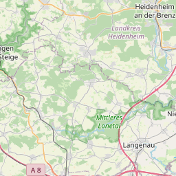
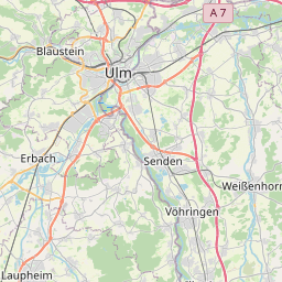
| Centre Point | 48.4443653,9.982747 |
| OSM | way 56754926 |
| Computed Postcode | 89081 |
| Address Tags | |
| Extra Tags | destination (motor_vehicle)
grade1 (tracktype)
|
| Local name | Type | OSM | Address rank | Admin level | Distance | |
| Lerchengartenweg | highway:track | way 56754926 | 26 | 0 | details > | |
| Beim Kleinen Gehrn | place:isolated_dwelling | node 714856067 | 20 | 0 | details > | |
| Ziegelweiler | place:isolated_dwelling | node 714856063 | 20 | 0 | details > | |
| Jungingen | place:village | way 33072918 | 16 | 0 | details > | |
| Ulm | place:city | relation 62495 | 12 | 6 | 0 | details > |
| Regierungsbezirk Tübingen | boundary:administrative | relation 2811874 | 10 | 5 | 0 | details > |
| Baden-Württemberg | place:state | relation 62611 | 8 | 4 | 0 | details > |
| 89081 | place:postcode | 5 | 0 | |||
| 89081 | place:postcode | relation 1141065 | 5 | 0 | details > | |
| Deutschland | place:country | relation 51477 | 4 | 2 | ~3 m | details > |
| de | place:country_code | 4 | 0 | |||
Parent Of | ||||||
Pitch | ||||||
| No Name | leisure:pitch | node 2004007373 | 30 | ~122 m | details > | |
| No Name | leisure:pitch | node 2004007376 | 30 | ~149 m | details > | |
| No Name | leisure:pitch | way 56755290 | 30 | ~104 m | details > | |
| No Name | leisure:pitch | way 220587614 | 30 | ~69 m | details > | |
| No Name | leisure:pitch | way 456611261 | 30 | ~100 m | details > | |
| No Name | leisure:pitch | way 26586489 | 30 | ~16 m | details > | |
Information | ||||||
| No Name | tourism:information | node 4533254675 | 30 | ~269 m | details > | |
Track | ||||||
| No Name | leisure:track | way 26586492 | 30 | ~23 m | details > | |