| Name | Neulandweg (name)
|
| Type | highway:residential |
| Last Updated | 2018-12-04 18:35 |
| Admin Level | 15 |
| Rank | Street / Major Landmark |
| Importance | 0.1 (estimated) |
| Coverage | Point |
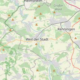
| Centre Point | 48.7213893,8.8798823 |
| OSM | way 59427703 |
| Computed Postcode | 71120 |
| Address Tags | |
| Extra Tags | 20 (maxspeed)
destination (motor_vehicle)
|
| Local name | Type | OSM | Address rank | Admin level | Distance | |
| Neulandweg | highway:residential | way 59427703 | 26 | 0 | details > | |
| Schafhausen | boundary:administrative | relation 4831571 | 20 | 10 | 0 | details > |
| Grafenau | boundary:administrative | relation 722156 | 16 | 8 | 0 | details > |
| Dätzingen | place:village | node 41107271 | 16 | 10 | 0 | details > |
| Schafhausen | place:village | node 44539565 | 16 | 0 | details > | |
| Ostelsheim | place:village | relation 933496 | 16 | 8 | 0 | details > |
| Weil der Stadt | place:town | relation 722152 | 16 | 8 | 0 | details > |
| Gemeindeverwaltungsverband Aidlingen/Grafenau | boundary:administrative | relation 1609073 | 14 | 7 | 0 | details > |
| Verwaltungsverband Althengstett | boundary:administrative | relation 2947000 | 14 | 7 | 0 | details > |
| Landkreis Böblingen | boundary:administrative | relation 62721 | 12 | 6 | 0 | details > |
| Landkreis Calw | boundary:administrative | relation 62601 | 12 | 6 | 0 | details > |
| Regierungsbezirk Karlsruhe | boundary:administrative | relation 22027 | 10 | 5 | 0 | details > |
| Regierungsbezirk Stuttgart | boundary:administrative | relation 22041 | 10 | 5 | 0 | details > |
| Baden-Württemberg | place:state | relation 62611 | 8 | 4 | 0 | details > |
| 71120 | place:postcode | 5 | 0 | |||
| 75395 | place:postcode | relation 3378982 | 5 | 0 | details > | |
| 71263 | place:postcode | relation 3378979 | 5 | 0 | details > | |
| 71120 | place:postcode | relation 3378988 | 5 | 0 | details > | |
| Deutschland | place:country | relation 51477 | 4 | 2 | ~3 m | details > |
| de | place:country_code | 4 | 0 |