| Name | Landersdorf (name)
Landersdorf (name:de)
RH 33 (ref)
|
| Type | highway:tertiary |
| Last Updated | 2018-12-04 10:17 |
| Admin Level | 15 |
| Rank | Street / Major Landmark |
| Importance | 0.1 (estimated) |
| Coverage | Point |
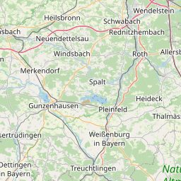
| Centre Point | 49.0657698,11.2459609 |
| OSM | way 68247717 |
| Computed Postcode | 91177 |
| Address Tags | |
| Extra Tags | 50 (maxspeed)
|
| Local name | Type | OSM | Address rank | Admin level | Distance | |
| Landersdorf | highway:tertiary | way 68247717 | 26 | 0 | details > | |
| Kätzelmühle | place:isolated_dwelling | node 1949956740 | 20 | 0 | details > | |
| Thalmässing | place:town | relation 158565 | 16 | 8 | 0 | details > |
| Feinschluck | place:hamlet | node 298844936 | 16 | 0 | details > | |
| Hundszell | place:hamlet | node 300649109 | 16 | 0 | details > | |
| Hagenich | place:village | node 300651011 | 16 | 0 | details > | |
| Gebersdorf | place:village | node 300651043 | 16 | 0 | details > | |
| Kochsmühle | place:hamlet | node 1949956736 | 16 | 0 | details > | |
| Landersdorf | place:village | node 298847600 | 16 | 0 | details > | |
| Göllersreuth | place:village | node 298845041 | 16 | 0 | details > | |
| Landkreis Roth | boundary:administrative | relation 62431 | 12 | 6 | 0 | details > |
| Mittelfranken | boundary:administrative | relation 17614 | 10 | 5 | 0 | details > |
| Bayern | place:state | relation 2145268 | 8 | 4 | 0 | details > |
| 91177 | place:postcode | 5 | 0 | |||
| 91177 | place:postcode | relation 1143687 | 5 | 0 | details > | |
| Deutschland | place:country | relation 51477 | 4 | 2 | ~2 m | details > |
| de | place:country_code | 4 | 0 | |||
Parent Of | ||||||
Post_box | ||||||
| Deutsche Post | amenity:post_box | node 3507303641 | 30 | ~56 m | details > | |
Bus_stop | ||||||
| Landersdorf | highway:bus_stop | node 5894691359 | 30 | ~53 m | details > | |
Building | ||||||
| No Name | building:yes | way 311507851 | 30 | ~18 m | details > | |
| No Name | building:yes | way 165658361 | 30 | ~3 m | details > | |
| No Name | building:yes | way 343948458 | 30 | ~8 m | details > | |
| No Name | building:yes | way 165658403 | 30 | ~16 m | details > | |
| No Name | building:yes | way 343948430 | 30 | ~53 m | details > | |
| No Name | building:yes | way 344287205 | 30 | ~81 m | details > | |
| No Name | building:yes | way 165658408 | 30 | ~54 m | details > | |
Bench | ||||||
| No Name | amenity:bench | node 4083068724 | 30 | ~515 m | details > | |
Information | ||||||
| No Name | tourism:information | node 3510272233 | 30 | ~65 m | details > | |