| Name | Kirchhofstraße (name)
|
| Type | highway:unclassified |
| Last Updated | 2018-12-04 18:34 |
| Admin Level | 15 |
| Rank | Street / Major Landmark |
| Importance | 0.1 (estimated) |
| Coverage | Point |
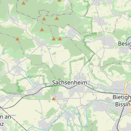
| Centre Point | 48.9581709,9.0652651 |
| OSM | way 74340742 |
| Computed Postcode | 74343 |
| Address Tags | |
| Extra Tags |
| Local name | Type | OSM | Address rank | Admin level | Distance | |
| Kirchhofstraße | highway:unclassified | way 74340742 | 26 | 0 | details > | |
| Sport- und Schulzentrum | place:neighbourhood | node 517985000 | 22 | 0 | details > | |
| Großsachsenheim | place:suburb | node 1586966923 | 20 | 0 | details > | |
| Sachsenheim | place:town | relation 405823 | 16 | 8 | 0 | details > |
| Unterriexingen | place:village | node 278321966 | 16 | 0 | details > | |
| Weißenhof | place:hamlet | node 1805940830 | 16 | 0 | details > | |
| Leonhardshof | place:hamlet | node 5002138585 | 16 | 0 | details > | |
| Egartenhof | place:hamlet | node 1457699329 | 16 | 0 | details > | |
| Untermberg | place:village | node 1457699328 | 16 | 0 | details > | |
| Landkreis Ludwigsburg | boundary:administrative | relation 62536 | 12 | 6 | 0 | details > |
| Regierungsbezirk Stuttgart | boundary:administrative | relation 22041 | 10 | 5 | 0 | details > |
| Baden-Württemberg | place:state | relation 62611 | 8 | 4 | 0 | details > |
| 74343 | place:postcode | 5 | 0 | |||
| 74343 | place:postcode | relation 1227771 | 5 | 0 | details > | |
| Deutschland | place:country | relation 51477 | 4 | 2 | ~3 m | details > |
| de | place:country_code | 4 | 0 | |||
Parent Of | ||||||
Building | ||||||
| No Name | building:yes | way 251666454 | 30 | ~34 m | details > | |
| No Name | building:yes | way 545054959 | 30 | ~6 m | details > | |
| No Name | building:yes | way 452280556 | 30 | ~22 m | details > | |
| No Name | building:yes | way 558291774 | 30 | ~7 m | details > | |
| No Name | building:yes | way 558291773 | 30 | ~13 m | details > | |
| No Name | building:yes | way 452281154 | 30 | ~14 m | details > | |
| No Name | building:yes | way 558291772 | 30 | ~21 m | details > | |
| No Name | building:yes | way 452281151 | 30 | ~23 m | details > | |
| No Name | building:yes | way 452281149 | 30 | ~42 m | details > | |
| No Name | building:yes | way 558291770 | 30 | ~54 m | details > | |
| No Name | building:yes | way 558291771 | 30 | ~63 m | details > | |