| Name | Zwieselsteig (name)
|
| Type | highway:path |
| Last Updated | 2018-12-05 13:06 |
| Admin Level | 15 |
| Rank | Minory Street / Path |
| Importance | 0.075 (estimated) |
| Coverage | Point |
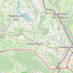
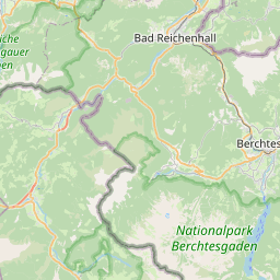
| Centre Point | 47.7601338,12.8101469 |
| OSM | way 77391215 |
| Computed Postcode | 83334 |
| Address Tags | |
| Extra Tags | down (incline)
mountain_hiking (sac_scale)
|
| Local name | Type | OSM | Address rank | Admin level | Distance | |
| Zwieselsteig | highway:path | way 77391215 | 27 | 0 | details > | |
| Höllenbachalm | place:isolated_dwelling | node 3632247093 | 20 | 0 | details > | |
| Inzell | place:village | relation 941683 | 16 | 8 | 0 | details > |
| Adlgaß | place:hamlet | node 496042833 | 16 | 0 | details > | |
| Rinnerauer | place:hamlet | node 1280038096 | 16 | 0 | details > | |
| Landkreis Traunstein | boundary:administrative | relation 2156363 | 12 | 6 | 0 | details > |
| Obb | boundary:administrative | relation 2145274 | 10 | 5 | ~1 m | details > |
| Bayern | place:state | relation 2145268 | 8 | 4 | ~2 m | details > |
| 83334 | place:postcode | 5 | 0 | |||
| 83334 | place:postcode | relation 1114742 | 5 | 0 | details > | |
| Deutschland | place:country | relation 51477 | 4 | 2 | ~4 m | details > |
| de | place:country_code | 4 | 0 | |||
Parent Of | ||||||
Information | ||||||
| DAV Sektion Bad Reichenhall | tourism:information | node 2431539654 | 30 | ~962 m | details > | |
| DAV Sektion Bad Reichenhall | tourism:information | node 2431539651 | 30 | ~1.4 km | details > | |
| DAV Sektion Bad Reichenhall | tourism:information | node 2459502569 | 30 | ~444 m | details > | |
| No Name | tourism:information | node 4896042689 | 30 | ~937 m | details > | |
| No Name | tourism:information | node 4104823232 | 30 | ~864 m | details > | |
| No Name | tourism:information | node 4104823286 | 30 | ~1.4 km | details > | |
| No Name | tourism:information | node 2431539650 | 30 | ~1.6 km | details > | |
| No Name | tourism:information | node 392231212 | 30 | ~1.7 km | details > | |
| No Name | tourism:information | node 4896042685 | 30 | ~1.4 km | details > | |
| No Name | tourism:information | node 4896042691 | 30 | ~1.3 km | details > | |
Water | ||||||
| Frillensee | natural:water | way 28355927 | 30 | ~716 m | details > | |
Spring | ||||||
| Goldenes Brünndl | natural:spring | node 5901282413 | 30 | ~950 m | details > | |
Building | ||||||
| Horchstation | building:yes | way 625009641 | 30 | ~933 m | details > | |
Alpine_hut | ||||||
| Kaiser-Wilhelm-Haus | tourism:alpine_hut | way 38839192 | 30 | ~1.4 km | details > | |
Restaurant | ||||||
| Kohleralm | amenity:restaurant | way 39090400 | 30 | ~1.3 km | details > | |
| Zwieselalm | amenity:restaurant | way 33914973 | 30 | ~1.4 km | details > | |
Cross | ||||||
| Zennokopf | man_made:cross | node 1964114027 | 30 | ~958 m | details > | |
Bench | ||||||
| No Name | amenity:bench | node 5149824627 | 30 | ~1.5 km | details > | |
| No Name | amenity:bench | node 4896042701 | 30 | ~1 km | details > | |
| No Name | amenity:bench | node 4104823245 | 30 | ~918 m | details > | |
| No Name | amenity:bench | node 1914694454 | 30 | ~1.4 km | details > | |
| No Name | amenity:bench | node 4104823246 | 30 | ~918 m | details > | |
| No Name | amenity:bench | node 4896042704 | 30 | ~970 m | details > | |
Shelter | ||||||
| No Name | amenity:shelter | way 238086434 | 30 | ~1.3 km | details > | |
| No Name | amenity:shelter | way 408593268 | 30 | ~906 m | details > | |
Platform | ||||||
| No Name | man_made:platform | way 408593255 | 30 | ~915 m | details > | |
Drinking_water | ||||||
| No Name | amenity:drinking_water | node 1330609302 | 30 | ~1.3 km | details > | |
| No Name | amenity:drinking_water | node 3670578602 | 30 | ~1 km | details > | |
Place_of_worship | ||||||
| No Name | amenity:place_of_worship | node 529483300 | 30 | ~1.4 km | details > | |
Viewpoint | ||||||
| No Name | tourism:viewpoint | node 1330609305 | 30 | ~669 m | details > | |
| No Name | tourism:viewpoint | node 3092935257 | 30 | ~766 m | details > | |