| Name | Horben (name)
|
| Type | landuse:residential |
| Last Updated | 2018-12-03 21:21 |
| Admin Level | 15 |
| Rank | Croft / Farm / Locality / Islet |
| Importance | 0.2 (estimated) |
| Coverage | Polygon |
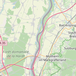
| Centre Point | 47.93453195,7.85880369244556 |
| OSM | way 88906652 |
| Computed Postcode | 79289 |
| Address Tags | |
| Extra Tags |
| Local name | Type | OSM | Address rank | Admin level | Distance | |
| Horben | landuse:residential | way 88906652 | 22 | 0 | details > | |
| Waibelhof | place:isolated_dwelling | node 1129711024 | 20 | 0 | details > | |
| Horben | place:village | relation 1948624 | 16 | 8 | 0 | details > |
| GVV Hexental | boundary:administrative | relation 1946226 | 14 | 7 | 0 | details > |
| Landkreis Breisgau-Hochschwarzwald | boundary:administrative | relation 1946367 | 12 | 6 | 0 | details > |
| Regierungsbezirk Freiburg | boundary:administrative | relation 2106112 | 10 | 5 | 0 | details > |
| Baden-Württemberg | place:state | relation 62611 | 8 | 4 | ~1 m | details > |
| 79289 | place:postcode | 5 | 0 | |||
| 79289 | place:postcode | relation 3371235 | 5 | 0 | details > | |
| Deutschland | place:country | relation 51477 | 4 | 2 | ~4 m | details > |
| de | place:country_code | 4 | 0 | |||
Parent Of | ||||||
Tertiary | ||||||
| Dorfstraße | highway:tertiary | way 143825770 | 26 | ~74 m | details > | |
| Dorfstraße | highway:tertiary | way 27451336 | 26 | ~6 m | details > | |
| Dorfstraße | highway:tertiary | way 456689751 | 26 | ~92 m | details > | |
| Dorfstraße | highway:tertiary | way 44612980 | 26 | ~271 m | details > | |
| Heubuck | highway:tertiary | way 456689758 | 26 | ~474 m | details > | |
| Heubuck | highway:tertiary | way 456689757 | 26 | ~461 m | details > | |
| Heubuck | highway:tertiary | way 456689755 | 26 | ~456 m | details > | |
| Heubuck | highway:tertiary | way 456689753 | 26 | ~386 m | details > | |
| Heubuck | highway:tertiary | way 431222880 | 26 | ~161 m | details > | |
| Heubuck | highway:tertiary | way 39117240 | 26 | ~192 m | details > | |
| Heubuck | highway:tertiary | way 287203935 | 26 | ~513 m | details > | |
| Heubuck | highway:tertiary | way 456689754 | 26 | ~406 m | details > | |
Unclassified | ||||||
| Dorfstraße | highway:unclassified | way 46213197 | 26 | ~313 m | details > | |
| Katzentalweg | highway:unclassified | way 287203936 | 26 | ~313 m | details > | |
| Mühleweg | highway:unclassified | way 24336522 | 26 | ~195 m | details > | |
Residential | ||||||
| Franz-Sigel-Weg | highway:residential | way 83509939 | 26 | ~192 m | details > | |
| Gustav-Struve-Weg | highway:residential | way 83509945 | 26 | ~290 m | details > | |
| Heubuck | highway:residential | way 54800642 | 26 | ~461 m | details > | |
| Heubuck | highway:residential | way 24336518 | 26 | ~161 m | details > | |
| Im Gründle | highway:residential | way 24336520 | 26 | ~62 m | details > | |
| Im Gründle | highway:residential | way 24336521 | 26 | ~77 m | details > | |
| Steinmühlenweg | highway:residential | way 24336519 | 26 | ~97 m | details > | |
| Steinmühlenweg | highway:residential | way 143825818 | 26 | ~92 m | details > | |
Living_street | ||||||
| Heubuck | highway:living_street | way 88895531 | 26 | ~467 m | details > | |
Service | ||||||
| Heubuck | highway:service | way 88895556 | 27 | ~450 m | details > | |
| Heubuck | highway:service | way 88895510 | 27 | ~390 m | details > | |