| Name | Dornhalde (name)
|
| Type | highway:service |
| Last Updated | 2018-12-05 15:41 |
| Admin Level | 15 |
| Rank | Minory Street / Path |
| Importance | 0.075 (estimated) |
| Coverage | Point |
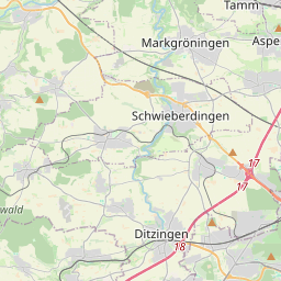
| Centre Point | 48.8348089,9.0739467 |
| OSM | way 100198209 |
| Computed Postcode | 71254 |
| Address Tags | |
| Extra Tags | 30 (maxspeed)
|
| Local name | Type | OSM | Address rank | Admin level | Distance | |
| Dornhalde | highway:service | way 100198209 | 27 | 0 | details > | |
| Langes Land | place:isolated_dwelling | node 254449076 | 20 | 0 | details > | |
| Ditzingen | place:town | relation 405817 | 16 | 8 | 0 | details > |
| Strohberg | place:hamlet | node 4068771355 | 16 | 0 | details > | |
| Landkreis Ludwigsburg | boundary:administrative | relation 62536 | 12 | 6 | 0 | details > |
| Regierungsbezirk Stuttgart | boundary:administrative | relation 22041 | 10 | 5 | 0 | details > |
| Baden-Württemberg | place:state | relation 62611 | 8 | 4 | 0 | details > |
| 71254 | place:postcode | 5 | 0 | |||
| 71254 | place:postcode | relation 3378010 | 5 | 0 | details > | |
| Deutschland | place:country | relation 51477 | 4 | 2 | ~3 m | details > |
| de | place:country_code | 4 | 0 | |||
Parent Of | ||||||
Building | ||||||
| No Name | building:yes | way 542742299 | 30 | ~17 m | details > | |
| No Name | building:yes | way 100198184 | 30 | ~18 m | details > | |
| No Name | building:yes | way 542742298 | 30 | ~6 m | details > | |
| No Name | building:yes | way 100198196 | 30 | ~8 m | details > | |
| No Name | building:yes | way 100198187 | 30 | ~5 m | details > | |
| No Name | building:yes | way 100198179 | 30 | ~19 m | details > | |
| No Name | building:yes | way 100198210 | 30 | ~24 m | details > | |