| Name | L 3229 (ref)
|
| Type | highway:secondary |
| Last Updated | 2018-12-04 16:59 |
| Admin Level | 15 |
| Rank | Street / Major Landmark |
| Importance | 0.1 (estimated) |
| Coverage | Point |
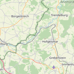
| Centre Point | 51.4729585,9.4487349 |
| OSM | way 8372538 |
| Computed Postcode | 34393 |
| Address Tags | |
| Extra Tags | 100 (maxspeed)
|
| Local name | Type | OSM | Address rank | Admin level | Distance | |
| L 3229 | highway:secondary | way 8372538 | 26 | 0 | details > | |
| Grebenstein | boundary:administrative | relation 8847269 | 20 | 10 | 0 | details > |
| Udenhausen | boundary:administrative | relation 8845312 | 18 | 9 | 0 | details > |
| Carlsdorf | boundary:administrative | relation 8847004 | 18 | 9 | 0 | details > |
| Hombressen | boundary:administrative | relation 8847003 | 18 | 9 | 0 | details > |
| Hofgeismar | place:town | relation 1112226 | 16 | 8 | 0 | details > |
| Udenhausen | place:village | node 264930860 | 16 | 0 | details > | |
| Carlsdorf | place:village | node 281915750 | 16 | 0 | details > | |
| Grebenstein | place:town | relation 455422 | 16 | 8 | 0 | details > |
| Landkreis Kassel | place:county | relation 62401 | 12 | 6 | 0 | details > |
| Regierungsbezirk Kassel | boundary:administrative | relation 286675 | 10 | 5 | 0 | details > |
| Hessen | place:state | relation 62650 | 8 | 4 | 0 | details > |
| 34393 | place:postcode | 5 | 0 | |||
| 34369 | place:postcode | relation 1189901 | 5 | 0 | details > | |
| 34393 | place:postcode | relation 3356563 | 5 | 0 | details > | |
| Deutschland | place:country | relation 51477 | 4 | 2 | 0 | details > |
| de | place:country_code | 4 | 0 | |||
| Europe | place:continent | node 25871341 | 2 | 0 | details > | |
Parent Of | ||||||
Emergency_access_point | ||||||
| KS-57 | highway:emergency_access_point | node 4677289302 | 30 | ~1.1 km | details > | |
Hunting_stand | ||||||
| No Name | amenity:hunting_stand | node 3242739529 | 30 | ~385 m | details > | |