| Name | Grebenstein (name)
|
| Type | boundary:administrative |
| Last Updated | 2018-12-03 18:40 |
| Admin Level | 10 |
| Rank | Suburb |
| Importance | 0.25 (estimated) |
| Coverage | Polygon |
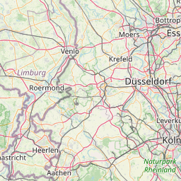
| Centre Point | 51.4512591,9.39464200351157 |
| OSM | relation 8847269 |
| Computed Postcode | 34393 |
| Address Tags | |
| Extra Tags | Stadt (name:prefix)
Q260708 (wikidata)
de:Grebenstein (wikipedia)
|
| Local name | Type | OSM | Address rank | Admin level | Distance | |
| Grebenstein | boundary:administrative | relation 8847269 | 20 | 10 | 0 | details > |
| Grebenstein | place:town | relation 455422 | 16 | 8 | 0 | details > |
| Landkreis Kassel | place:county | relation 62401 | 12 | 6 | 0 | details > |
| Regierungsbezirk Kassel | boundary:administrative | relation 286675 | 10 | 5 | 0 | details > |
| Hessen | place:state | relation 62650 | 8 | 4 | 0 | details > |
| 34393 | place:postcode | 5 | 0 | |||
| Deutschland | place:country | relation 51477 | 4 | 2 | 0 | details > |
| de | place:country_code | 4 | 0 | |||
| Europe | place:continent | node 25871341 | 2 | 0 | details > | |
Parent Of | ||||||
Cemetery | ||||||
| Friedhof Grebenstein | landuse:cemetery | way 104674024 | 0 | ~1.1 km | details > | |
Park | ||||||
| Freibad Grebenstein | leisure:park | way 104652943 | 0 | ~607 m | details > | |
| No Name | leisure:park | way 130170115 | 0 | ~1.2 km | details > | |
| No Name | leisure:park | way 292488707 | 0 | ~1.6 km | details > | |
| No Name | leisure:park | way 129240461 | 0 | ~1.4 km | details > | |
| No Name | leisure:park | way 363048644 | 0 | ~1.6 km | details > | |
Postcode | ||||||
| 34393 | place:postcode | relation 3356563 | 11 | ~1.1 km | details > | |
Allotments | ||||||
| Auf den Cellicken | landuse:allotments | way 107418664 | 22 | ~1.4 km | details > | |
Farmyard | ||||||
| Birkenhof | landuse:farmyard | way 106390328 | 22 | ~2.7 km | details > | |
| Dornemanns Hof | landuse:farmyard | way 106493289 | 22 | ~1.1 km | details > | |
| Giedenhof | landuse:farmyard | way 313546488 | 22 | ~3.4 km | details > | |
| Hartigs Hof | landuse:farmyard | way 106493286 | 22 | ~3.3 km | details > | |
| Hof Butzbach | landuse:farmyard | way 106390334 | 22 | ~3.7 km | details > | |
| Hof Sprinkenthal | landuse:farmyard | way 106390311 | 22 | ~2.9 km | details > | |
| Kramms Hof | landuse:farmyard | way 106390326 | 22 | ~2.6 km | details > | |
| Lecks Hof | landuse:farmyard | way 106390315 | 22 | ~2.5 km | details > | |
| Melchers Hof | landuse:farmyard | way 282882151 | 22 | ~1.7 km | details > | |
| Pfeiffers Hof | landuse:farmyard | way 106390304 | 22 | ~2.3 km | details > | |
Residential | ||||||
| Ahornweg | highway:residential | way 38716522 | 26 | ~909 m | details > | |
| Am Leimberg | highway:residential | way 46336965 | 26 | ~1.4 km | details > | |
| Am Papengrund | highway:residential | way 43710718 | 26 | ~1.2 km | details > | |
| Am Wassergraben | highway:residential | way 33899920 | 26 | ~1 km | details > | |
| Am Wippeteich | highway:residential | way 43710714 | 26 | ~1.2 km | details > | |
| Anesorgenstraße | highway:residential | way 43712032 | 26 | ~688 m | details > | |
| Auf dem Wildhagen | highway:residential | way 38716524 | 26 | ~859 m | details > | |
| Bahnhof | highway:residential | way 128436729 | 26 | ~1.7 km | details > | |
| Bahnhof | highway:residential | way 43710115 | 26 | ~1.8 km | details > | |
| Bahnhof | highway:residential | way 128436728 | 26 | ~1.8 km | details > | |
| Berliner Straße | highway:residential | way 43712877 | 26 | ~1.1 km | details > | |
| Blauer Wandstein | highway:residential | way 43070208 | 26 | ~1.5 km | details > | |
| Breslauer Straße | highway:residential | way 43712745 | 26 | ~1.2 km | details > | |
| Burgtor | highway:residential | way 46337032 | 26 | ~1.6 km | details > | |
| Burguffelner Straße | highway:residential | way 107323700 | 26 | ~1.6 km | details > | |
| Burguffelner Straße | highway:residential | way 26707022 | 26 | ~1.9 km | details > | |
| Danziger Straße | highway:residential | way 43712900 | 26 | ~1.1 km | details > | |
| Dreimännchen | highway:residential | way 46337087 | 26 | ~1.7 km | details > | |
| Eichendorffweg | highway:residential | way 43711464 | 26 | ~898 m | details > | |
| Erlenweg | highway:residential | way 43712527 | 26 | ~972 m | details > | |
| Eulenberg | highway:residential | way 43070559 | 26 | ~1.5 km | details > | |
| Eulenberg | highway:residential | way 193066702 | 26 | ~1.5 km | details > | |
| Eulenberg | highway:residential | way 193066703 | 26 | ~1.4 km | details > | |
| Eulenberg | highway:residential | way 129242163 | 26 | ~1.5 km | details > | |
| Eulenberg | highway:residential | way 129240292 | 26 | ~1.5 km | details > | |
| Eulenbergstraße | highway:residential | way 106671241 | 26 | ~1.4 km | details > | |
| Eulenbergstraße | highway:residential | way 43758173 | 26 | ~1.4 km | details > | |
| Freienhof | highway:residential | way 130044170 | 26 | ~1.4 km | details > | |
| Freienhof | highway:residential | way 43070534 | 26 | ~1.3 km | details > | |
| Gartenstraße | highway:residential | way 43709807 | 26 | ~1.9 km | details > | |
| Gartenstraße | highway:residential | way 43715927 | 26 | ~2.1 km | details > | |
| Gartenstraße | highway:residential | way 43709810 | 26 | ~2.1 km | details > | |
| Geismarscher Weg | highway:residential | way 27862159 | 26 | ~1.3 km | details > | |
| Geroldstraße | highway:residential | way 123561678 | 26 | ~857 m | details > | |
| Goethestraße | highway:residential | way 43711451 | 26 | ~908 m | details > | |
| Graben | highway:residential | way 43070531 | 26 | ~1.5 km | details > | |
| Grimmsche Straße | highway:residential | way 46336855 | 26 | ~785 m | details > | |
| Gustav-Menzel-Straße | highway:residential | way 33899911 | 26 | ~1 km | details > | |
| Gänsemarkt | highway:residential | way 130012995 | 26 | ~1.3 km | details > | |
| Hochzeitsstraße | highway:residential | way 30111707 | 26 | ~1.4 km | details > | |
| Hofbreite | highway:residential | way 43709992 | 26 | ~1.9 km | details > | |
| Holzstätte | highway:residential | way 43718330 | 26 | ~1.9 km | details > | |
| Hölderlinstraße | highway:residential | way 43711459 | 26 | ~772 m | details > | |
| Höllegasse | highway:residential | way 46336914 | 26 | ~1.6 km | details > | |
| Höpperstraße | highway:residential | way 38212808 | 26 | ~1.5 km | details > | |
| Immenhäuser Straße | highway:residential | way 43709951 | 26 | ~1.8 km | details > | |
| Immenhäuser Straße | highway:residential | way 323898235 | 26 | ~1.9 km | details > | |
| Karl-Schomburg-Straße | highway:residential | way 33899916 | 26 | ~1.1 km | details > | |
| Kasseler Straße | highway:residential | way 43710337 | 26 | ~1.2 km | details > | |
| Kelzer Weg | highway:residential | way 128436734 | 26 | ~1.1 km | details > | |
| Kelzer Weg | highway:residential | way 128436733 | 26 | ~1.1 km | details > | |
| Kelzer Weg | highway:residential | way 26707087 | 26 | ~1 km | details > | |
| Kelzer Weg | highway:residential | way 26707083 | 26 | ~832 m | details > | |
| Kelzer Weg | highway:residential | way 27862116 | 26 | ~1.3 km | details > | |
| Kelzer Weg | highway:residential | way 26707065 | 26 | ~1.1 km | details > | |
| Königsberger Straße | highway:residential | way 43712904 | 26 | ~1.1 km | details > | |
| Landgraf-Heinrich-Straße | highway:residential | way 43712285 | 26 | ~574 m | details > | |
| Lessingstraße | highway:residential | way 43711462 | 26 | ~863 m | details > | |
| Lezouxer Straße | highway:residential | way 43069937 | 26 | ~1.7 km | details > | |
| Lezouxer Straße | highway:residential | way 100719783 | 26 | ~1.8 km | details > | |
| Lezouxer Straße | highway:residential | way 100719804 | 26 | ~1.8 km | details > | |
| Lindenstraße | highway:residential | way 43757999 | 26 | ~1.1 km | details > | |
| Lopiker Straße | highway:residential | way 100719796 | 26 | ~1.9 km | details > | |
| Lopiker Straße | highway:residential | way 99341979 | 26 | ~1.8 km | details > | |
| Lopiker Straße | highway:residential | way 100719805 | 26 | ~1.8 km | details > | |
| Ludolph-von-Dassel-Straße | highway:residential | way 38716520 | 26 | ~678 m | details > | |
| Lärchenweg | highway:residential | way 38716521 | 26 | ~845 m | details > | |
| Neue Straße | highway:residential | way 33899918 | 26 | ~1.3 km | details > | |
| Ob der Claus | highway:residential | way 43710739 | 26 | ~1 km | details > | |
| Obere Hofstraße | highway:residential | way 43070297 | 26 | ~1.2 km | details > | |
| Obere Schnurstraße | highway:residential | way 43070369 | 26 | ~1.2 km | details > | |
| Obere Strohstraße | highway:residential | way 43070330 | 26 | ~1.2 km | details > | |
| Raiffeisenstraße | highway:residential | way 38716523 | 26 | ~779 m | details > | |
| Riethweg | highway:residential | way 9224278 | 26 | ~1 km | details > | |
| Sarsinaer Straße | highway:residential | way 106225063 | 26 | ~1.7 km | details > | |
| Sarsinaer Straße | highway:residential | way 37553571 | 26 | ~1.7 km | details > | |
| Sauertalsweg | highway:residential | way 46337297 | 26 | ~840 m | details > | |
| Sauertalsweg | highway:residential | way 26363094 | 26 | ~1.1 km | details > | |
| Schachtener Straße | highway:residential | way 192902212 | 26 | ~1.5 km | details > | |
| Schachtener Straße | highway:residential | way 193640730 | 26 | ~1.5 km | details > | |
| Schachtener Straße | highway:residential | way 107323687 | 26 | ~1.6 km | details > | |
| Schachtener Straße | highway:residential | way 27862383 | 26 | ~1.5 km | details > | |
| Schachtener Straße | highway:residential | way 192902210 | 26 | ~1.6 km | details > | |
| Schillerstraße | highway:residential | way 124331549 | 26 | ~1 km | details > | |
| Schinderberg | highway:residential | way 107323690 | 26 | ~1.6 km | details > | |
| Schinderberg | highway:residential | way 37553623 | 26 | ~1.6 km | details > | |
| Schinderberg | highway:residential | way 30111675 | 26 | ~1.5 km | details > | |
| Schlesische Straße | highway:residential | way 27862124 | 26 | ~1.3 km | details > | |
| Steinerne Brücke | highway:residential | way 129099275 | 26 | ~1.3 km | details > | |
| Steinerne Brücke | highway:residential | way 129099274 | 26 | ~1.6 km | details > | |
| Steinerne Brücke | highway:residential | way 64972137 | 26 | ~1.5 km | details > | |
| Steinhöfe | highway:residential | way 43069921 | 26 | ~1.9 km | details > | |
| Steinweg | highway:residential | way 193066785 | 26 | ~1.5 km | details > | |
| Steinweg | highway:residential | way 136200140 | 26 | ~1.5 km | details > | |
| Steinweg | highway:residential | way 193066786 | 26 | ~1.5 km | details > | |
| Steinweg | highway:residential | way 43758409 | 26 | ~1.5 km | details > | |
| Steinweg | highway:residential | way 136200141 | 26 | ~1.5 km | details > | |
| Stettiner Straße | highway:residential | way 43712902 | 26 | ~1.1 km | details > | |
| Storch | highway:residential | way 38212809 | 26 | ~1.5 km | details > | |
| Sudetenstraße | highway:residential | way 27862148 | 26 | ~1.3 km | details > | |
| Udenhäuser Straße | highway:residential | way 323898234 | 26 | ~1.8 km | details > | |
| Udenhäuser Straße | highway:residential | way 27862370 | 26 | ~1.6 km | details > | |
| Ulmenweg | highway:residential | way 43711740 | 26 | ~779 m | details > | |
| Unter dem Wassergraben | highway:residential | way 43713003 | 26 | ~1.1 km | details > | |
| Untere Hofstraße | highway:residential | way 43070239 | 26 | ~1.4 km | details > | |
| Untere Schnurstraße | highway:residential | way 38212810 | 26 | ~1.5 km | details > | |
| Untere Strohstraße | highway:residential | way 43070236 | 26 | ~1.4 km | details > | |
| Wilhelm-Pfeffer-Straße | highway:residential | way 43710453 | 26 | ~1.1 km | details > | |
| Wilhelm-Vesper-Straße | highway:residential | way 8610728 | 26 | ~765 m | details > | |
| Wilhelm-Vesper-Straße | highway:residential | way 43711562 | 26 | ~720 m | details > | |
| Ziegenrück | highway:residential | way 46336917 | 26 | ~1.6 km | details > | |
| Ziegenrück | highway:residential | way 107444985 | 26 | ~1.7 km | details > | |
| Ziegenrück | highway:residential | way 46336913 | 26 | ~1.6 km | details > | |
| Zum Burgberg | highway:residential | way 142269181 | 26 | ~1.9 km | details > | |
| Zum Burgberg | highway:residential | way 130044175 | 26 | ~1.9 km | details > | |
| Zum Burgberg | highway:residential | way 54538207 | 26 | ~1.8 km | details > | |
| Über dem Grimmschen Hof | highway:residential | way 43757908 | 26 | ~585 m | details > | |
| Über dem Grimmschen Hof | highway:residential | way 43712368 | 26 | ~601 m | details > | |
| Über dem Maibach | highway:residential | way 33899909 | 26 | ~1.4 km | details > | |
| Über der Bahn | highway:residential | way 43070040 | 26 | ~1.8 km | details > | |
| Überm Sauertal | highway:residential | way 46336821 | 26 | ~582 m | details > | |
| No Name | highway:residential | way 28046404 | 26 | ~1.5 km | details > | |
| No Name | highway:residential | way 43713494 | 26 | ~1.1 km | details > | |
Track | ||||||
| Altes Viadukt | highway:track | way 226254144 | 26 | ~2.7 km | details > | |
| Am Offenberg | highway:track | way 106343207 | 26 | ~3.7 km | details > | |
| Am unteren Teich | highway:track | way 405687399 | 26 | ~1.5 km | details > | |
| Bruchmühle | highway:track | way 99315143 | 26 | ~1.2 km | details > | |
| Bruchmühle | highway:track | way 375626280 | 26 | ~1.3 km | details > | |
| Dornemannshof | highway:track | way 100719787 | 26 | ~1.1 km | details > | |
| Ellixen | highway:track | way 100719786 | 26 | ~1.2 km | details > | |
| Ellixen | highway:track | way 100719802 | 26 | ~1.3 km | details > | |
| Giedenhof | highway:track | way 43068741 | 26 | ~3.3 km | details > | |
| Gradhöhe | highway:track | way 106273752 | 26 | ~2.2 km | details > | |
| Hof Sprinkenthal | highway:track | way 124523694 | 26 | ~2.9 km | details > | |
| Im Grafsiegen | highway:track | way 213921844 | 26 | ~2.1 km | details > | |
| Im Nesselbach | highway:track | way 107445371 | 26 | ~1.1 km | details > | |
| Im Nesselbach | highway:track | way 107445370 | 26 | ~1.1 km | details > | |
| Im Nesselbach | highway:track | way 100719780 | 26 | ~1.1 km | details > | |
| Kelzer Weg | highway:track | way 26707124 | 26 | ~716 m | details > | |
| Kressenbrunner Weg | highway:track | way 96346370 | 26 | ~2.1 km | details > | |
| Melchershof | highway:track | way 105920676 | 26 | ~1.3 km | details > | |
| Oberhaldessen | highway:track | way 106493298 | 26 | ~3.5 km | details > | |
| Schlüchter Graben | highway:track | way 100719792 | 26 | ~1.7 km | details > | |
| Trasse alte Friedrich-Wilhelm-Nordbahn | highway:track | way 226253871 | 26 | ~2.4 km | details > | |
| Trasse alte Friedrich-Wilhelm-Nordbahn | highway:track | way 201208710 | 26 | ~2.6 km | details > | |
| Trasse alte Friedrich-Wilhelm-Nordbahn | highway:track | way 226254143 | 26 | ~2.7 km | details > | |
Primary | ||||||
| B 83 | highway:primary | way 58717226 | 26 | ~1.1 km | details > | |
| B 83 | highway:primary | way 111318335 | 26 | ~1.1 km | details > | |
| B 83 | highway:primary | way 503242903 | 26 | ~1.9 km | details > | |
| B 83 | highway:primary | way 386866670 | 26 | ~1.1 km | details > | |
| B 83 | highway:primary | way 253665354 | 26 | ~1.9 km | details > | |
| B 83 | highway:primary | way 253665378 | 26 | ~1.1 km | details > | |
| B 83 | highway:primary | way 253665389 | 26 | ~1.6 km | details > | |
| B 83 | highway:primary | way 253665360 | 26 | ~1.2 km | details > | |
| B 83 | highway:primary | way 253665366 | 26 | ~1.1 km | details > | |
| B 83 | highway:primary | way 253665370 | 26 | ~1.4 km | details > | |
| B 83 | highway:primary | way 503242900 | 26 | ~1.8 km | details > | |
| B 83 | highway:primary | way 503242897 | 26 | ~1.5 km | details > | |
| B 83 | highway:primary | way 253665385 | 26 | ~1.9 km | details > | |
| B 83 | highway:primary | way 253665381 | 26 | ~1.1 km | details > | |
| B 83 | highway:primary | way 253665371 | 26 | ~1.5 km | details > | |
| B 83 | highway:primary | way 27862398 | 26 | ~1.5 km | details > | |
| B 83 | highway:primary | way 111318336 | 26 | ~1.4 km | details > | |
| B 83 | highway:primary | way 135639977 | 26 | ~1.1 km | details > | |
| B 83 | highway:primary | way 253665353 | 26 | ~1.2 km | details > | |
| B 83 | highway:primary | way 253665358 | 26 | ~1.4 km | details > | |
| B 83 | highway:primary | way 253665367 | 26 | ~1.4 km | details > | |
| B 83 | highway:primary | way 253665391 | 26 | ~1.2 km | details > | |
| B 83 | highway:primary | way 135639964 | 26 | ~1.2 km | details > | |
| B 83 | highway:primary | way 253665375 | 26 | ~2.4 km | details > | |
| B 83 | highway:primary | way 253665390 | 26 | ~1.1 km | details > | |
| B 83 | highway:primary | way 253665388 | 26 | ~1.5 km | details > | |
| B 83 | highway:primary | way 386866675 | 26 | ~1.1 km | details > | |
| B 83 | highway:primary | way 172752459 | 26 | ~1.1 km | details > | |
| B 83 | highway:primary | way 58717227 | 26 | ~2.2 km | details > | |
Secondary | ||||||
| Bahnhofstraße | highway:secondary | way 142269172 | 26 | ~1.6 km | details > | |
| Bahnhofstraße | highway:secondary | way 24406282 | 26 | ~1.9 km | details > | |
| Bahnhofstraße | highway:secondary | way 432234126 | 26 | ~1.7 km | details > | |
| Bahnhofstraße | highway:secondary | way 24417221 | 26 | ~1.9 km | details > | |
| Bahnhofstraße | highway:secondary | way 432234125 | 26 | ~1.7 km | details > | |
| Bahnhofstraße | highway:secondary | way 128436730 | 26 | ~1.8 km | details > | |
| Bahnhofstraße | highway:secondary | way 136200137 | 26 | ~1.7 km | details > | |
| Bahnhofstraße | highway:secondary | way 136200138 | 26 | ~1.8 km | details > | |
| Bahnhofstraße | highway:secondary | way 24406281 | 26 | ~1.4 km | details > | |
| Friedrichsthaler Straße | highway:secondary | way 142269174 | 26 | ~577 m | details > | |
| Friedrichsthaler Straße | highway:secondary | way 142269173 | 26 | ~1.2 km | details > | |
| Friedrichsthaler Straße | highway:secondary | way 398965938 | 26 | ~1.9 km | details > | |
| Friedrichsthaler Straße | highway:secondary | way 398965940 | 26 | ~1.8 km | details > | |
| Friedrichsthaler Straße | highway:secondary | way 503242911 | 26 | ~1.1 km | details > | |
| Friedrichsthaler Straße | highway:secondary | way 124951671 | 26 | ~815 m | details > | |
| Friedrichsthaler Straße | highway:secondary | way 616297543 | 26 | ~1.1 km | details > | |
| Friedrichsthaler Straße | highway:secondary | way 231391809 | 26 | ~513 m | details > | |
| Friedrichsthaler Straße | highway:secondary | way 503242912 | 26 | ~1.1 km | details > | |
| Friedrichsthaler Straße | highway:secondary | way 108507723 | 26 | ~486 m | details > | |
| Friedrichsthaler Straße | highway:secondary | way 108507724 | 26 | ~689 m | details > | |
| Friedrichsthaler Straße | highway:secondary | way 128441059 | 26 | ~1.1 km | details > | |
| Friedrichsthaler Straße | highway:secondary | way 33899925 | 26 | ~1.2 km | details > | |
| Friedrichsthaler Straße | highway:secondary | way 397763162 | 26 | ~2.3 km | details > | |
| Friedrichsthaler Straße | highway:secondary | way 33899924 | 26 | ~1.2 km | details > | |
| Friedrichsthaler Straße | highway:secondary | way 398965939 | 26 | ~542 m | details > | |
| Grebensteiner Straße | highway:secondary | way 9069493 | 26 | ~1.9 km | details > | |
| Grebensteiner Straße | highway:secondary | way 405691616 | 26 | ~3.8 km | details > | |
| Grebensteiner Straße | highway:secondary | way 386699059 | 26 | ~1.9 km | details > | |
| Grebensteiner Straße | highway:secondary | way 386699061 | 26 | ~2.6 km | details > | |
| Grebensteiner Straße | highway:secondary | way 231391810 | 26 | ~2.1 km | details > | |
| L 3229 | highway:secondary | way 8372538 | 26 | ~4.3 km | details > | |
| L 3233 | highway:secondary | way 22944804 | 26 | ~2.9 km | details > | |
| Mainzer Breite | highway:secondary | way 231391812 | 26 | ~3.1 km | details > | |
| Mainzer Breite | highway:secondary | way 231391813 | 26 | ~3.1 km | details > | |
| Mainzer Breite | highway:secondary | way 405691617 | 26 | ~2.7 km | details > | |
| Mainzer Breite | highway:secondary | way 386699058 | 26 | ~2.9 km | details > | |
| Marktstraße | highway:secondary | way 22944805 | 26 | ~1.2 km | details > | |
| Obertor | highway:secondary | way 123455751 | 26 | ~1.2 km | details > | |
Tertiary | ||||||
| Bahnhofstraße | highway:tertiary | way 62192400 | 26 | ~1.9 km | details > | |
| Hofgeismarer Straße | highway:tertiary | way 22944802 | 26 | ~1.2 km | details > | |
| Hofgeismarer Straße | highway:tertiary | way 128436731 | 26 | ~1.3 km | details > | |
| Hofgeismarer Straße | highway:tertiary | way 106168914 | 26 | ~1.3 km | details > | |
| Hofgeismarer Straße | highway:tertiary | way 105328952 | 26 | ~1.1 km | details > | |
| Hofgeismarer Straße | highway:tertiary | way 104673679 | 26 | ~1.1 km | details > | |
| Hofgeismarer Straße | highway:tertiary | way 104673689 | 26 | ~1.1 km | details > | |
| Hofgeismarer Straße | highway:tertiary | way 106168911 | 26 | ~1.2 km | details > | |
| Hofgeismarer Straße | highway:tertiary | way 386699062 | 26 | ~1.2 km | details > | |
| Hofgeismarer Straße | highway:tertiary | way 172752476 | 26 | ~1.1 km | details > | |
| K 50 | highway:tertiary | way 27252287 | 26 | ~1.4 km | details > | |
| K 50 | highway:tertiary | way 183718193 | 26 | ~1.2 km | details > | |
| K 50 | highway:tertiary | way 104652950 | 26 | ~1.4 km | details > | |
| K 50 | highway:tertiary | way 104652951 | 26 | ~1.4 km | details > | |
| K 50 | highway:tertiary | way 105328951 | 26 | ~1.4 km | details > | |
| K 50 | highway:tertiary | way 172752479 | 26 | ~1.4 km | details > | |
| K 51 | highway:tertiary | way 106343209 | 26 | ~3.2 km | details > | |
| K 51 | highway:tertiary | way 24406247 | 26 | ~2.1 km | details > | |
| K 51 | highway:tertiary | way 386699063 | 26 | ~1.9 km | details > | |
| Markt | highway:tertiary | way 121788504 | 26 | ~1.4 km | details > | |
| Schachtener Straße | highway:tertiary | way 503242909 | 26 | ~1.3 km | details > | |
| Schachtener Straße | highway:tertiary | way 503242908 | 26 | ~1.4 km | details > | |
| Schachtener Straße | highway:tertiary | way 27252288 | 26 | ~1.2 km | details > | |
| Schachtener Straße | highway:tertiary | way 503242907 | 26 | ~1.3 km | details > | |
| Schachtener Straße | highway:tertiary | way 398960820 | 26 | ~1.4 km | details > | |
| Wegelange | highway:tertiary | way 34778407 | 26 | ~4.6 km | details > | |
Unclassified | ||||||
| Sauertal | highway:unclassified | way 110297181 | 26 | ~786 m | details > | |
| Sauertalsweg | highway:unclassified | way 43710403 | 26 | ~1.1 km | details > | |
| No Name | highway:unclassified | way 104530011 | 26 | ~1 km | details > | |
| No Name | highway:unclassified | way 105328944 | 26 | ~825 m | details > | |
| No Name | highway:unclassified | way 193288257 | 26 | ~706 m | details > | |
| No Name | highway:unclassified | way 210666371 | 26 | ~852 m | details > | |
| No Name | highway:unclassified | way 43710350 | 26 | ~1.1 km | details > | |
| No Name | highway:unclassified | way 210666377 | 26 | ~1 km | details > | |
| No Name | highway:unclassified | way 46512845 | 26 | ~714 m | details > | |
Service | ||||||
| Burgmühle | highway:service | way 194741444 | 27 | ~1.7 km | details > | |
| Dornemannshof | highway:service | way 281971307 | 27 | ~1.1 km | details > | |
| Hochzeitsberg | highway:service | way 292488705 | 27 | ~1.5 km | details > | |
| Steinmühle | highway:service | way 129099276 | 27 | ~1.5 km | details > | |
| Steinmühle | highway:service | way 100722719 | 27 | ~1.5 km | details > | |
| Steinmühle | highway:service | way 129099277 | 27 | ~1.5 km | details > | |
Path | ||||||
| Hochzeitsberg | highway:path | way 38212811 | 27 | ~1.5 km | details > | |
| Waldlehrpfad | highway:path | way 114996238 | 27 | ~905 m | details > | |
Footway | ||||||
| Lessingstraße | highway:footway | way 43786505 | 27 | ~818 m | details > | |