| Name | Sauertalsweg (name)
|
| Type | highway:residential |
| Last Updated | 2018-12-04 16:55 |
| Admin Level | 15 |
| Rank | Street / Major Landmark |
| Importance | 0.1 (estimated) |
| Coverage | Point |
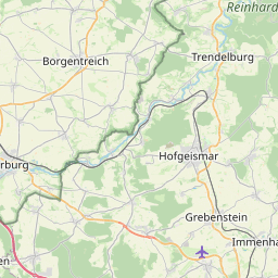
| Centre Point | 51.4490488,9.4118038 |
| OSM | way 26363094 |
| Computed Postcode | 34393 |
| Address Tags | |
| Extra Tags |
| Local name | Type | OSM | Address rank | Admin level | Distance | |
| Sauertalsweg | highway:residential | way 26363094 | 26 | 0 | details > | |
| Grebenstein | boundary:administrative | relation 8847269 | 20 | 10 | 0 | details > |
| Grebenstein | place:town | relation 455422 | 16 | 8 | 0 | details > |
| Landkreis Kassel | place:county | relation 62401 | 12 | 6 | 0 | details > |
| Regierungsbezirk Kassel | boundary:administrative | relation 286675 | 10 | 5 | 0 | details > |
| Hessen | place:state | relation 62650 | 8 | 4 | 0 | details > |
| 34393 | place:postcode | 5 | 0 | |||
| 34393 | place:postcode | relation 3356563 | 5 | 0 | details > | |
| Deutschland | place:country | relation 51477 | 4 | 2 | 0 | details > |
| de | place:country_code | 4 | 0 | |||
| Europe | place:continent | node 25871341 | 2 | 0 | details > | |
Parent Of | ||||||
Kindergarten | ||||||
| Kindergarten | amenity:kindergarten | node 1225100965 | 30 | ~25 m | details > | |
Parking | ||||||
| Nette | amenity:parking | node 1412285905 | 30 | ~114 m | details > | |
| No Name | amenity:parking | way 192891539 | 30 | ~49 m | details > | |
Building | ||||||
| Sporthalle | building:yes | way 104522523 | 30 | ~73 m | details > | |
Playground | ||||||
| No Name | leisure:playground | node 966078057 | 30 | ~100 m | details > | |
Pitch | ||||||
| No Name | leisure:pitch | way 192891537 | 30 | ~54 m | details > | |